London Map Explained: Zones, Boroughs And Landmarks
Plan smarter with a London map explained in plain English: Tube zones, boroughs, central London, landmarks, apps and visitor mistakes to avoid.
Author:James RowleyJun 02, 202681 Shares81.1K Views
Quick Answer: Which London Map Do You Need?
Londonis a large capital made up of layers: transport zones, boroughs, neighbourhoods, landmarks, parks, rivers, roads and railway lines. Each layer helps with a different decision.
Most visitors do not need to memorise every borough or station. You mainly need to know where your sights are clustered, which transport map gets you between them, and when a map is showing a fare zone rather than a real neighbourhood.
A Tube map helps you move across London. A tourist map helps you group landmarks. A borough map explains local boundaries. A central London maphelps you understand where most first-time sightseeing happens. The trick is knowing which one to use before you plan your day.
If your main question is transport rather than geography, start with our complete guide on how to get around Londonbefore choosing a route.
| Need | Map to use |
| Getting around by Tube or rail | TfL Tube and rail map |
| Seeing famous landmarks | London tourist attractions map |
| Understanding visitor areas | Central London or neighbourhood map |
| Understanding local boundaries | London borough map |
| Planning step-free travel | TfL step-free or large-print maps |
| Driving into London | TfL Congestion Charge, ULEZ or LEZ maps |
| Checking real-time weather, traffic and street crowds | Live London webcams |
Key Takeaways
- Use TfL maps for transport, accessibility and driving-zone decisions.
- Use Visit London maps for attractions, sightseeing areas and visitor planning.
- Treat Zone 1 as a useful transport centre, not a perfect definition of central London.
- Remember that boroughs, neighbourhoods, zones and postcodes are different systems.
- Do not rely on the image alone; always read the legend, symbols and source notes.
A good London map does not answer every question. It helps you ask the right next question.
Data as of 2026: London transport maps, service names, station access and driving zones can change. Transport for London lists official mapsfor Tube and rail, bus, cycle, river, Congestion Charge, ULEZ, LEZ, red routes and Oyster Ticket Stops, so check the latest official version before travelling.
Map Summary: What A London Map Actually Means
A “London map” can mean several different things. Searchers often use the same phrase when they need a Tube map, a map of London zones, a central London map, a tourist map, a London borough map or a London landmarks map.
If your main goal is sightseeing, start with a London attractions mapbefore switching to TfL for transport.
The fastest way to avoid confusion is to decide what the map is supposed to help you do.
| Use case | Practical decision |
| First-time sightseeing | Start with a central London tourist map, then use TfL for transport. |
| Hotel planning | Compare the hotel area with nearby stations and attraction clusters. |
| Public transport | Use current TfL Tube, rail, bus or river maps. |
| Walking between sights | Use a tourist or street map, not only the Tube map. |
| Borough research | Use a London borough map or official boundary data. |
| Accessible travel | Use TfL’s step-free and large-print resources. |
Visit London’s free map resources are provided by official sources, including TfL, and are designed to help visitors navigate sights, parks, museums and historic landmarks.
Official Sources To Check First
For transport, start with TfL. For visitor planning, start with Visit London. For borough boundaries, use London Councils or London Datastore. For the Square Mile, use City of London Corporation resources.
TfL also has a dedicated visitor maps pagecovering Tube, bus, rail, cycle and river maps, which is useful when you are choosing the right transport layer rather than guessing from a generic image.
Freshness Note: Verify Current Maps Before Travelling
Static maps are useful for planning, but they cannot show every current service change, station issue or accessibility update. Use the map to shape your route, then check the latest official source before you leave.
What The Map Shows
A London map can show lines, zones, boroughs, landmarks, roads, walking routes, cycle routes, rivers, accessibility symbols and charging boundaries. The problem is that no single map shows all of these equally well.
This section explains what each map layer usually means, so you can turn the image into a real visitor or driver decision.
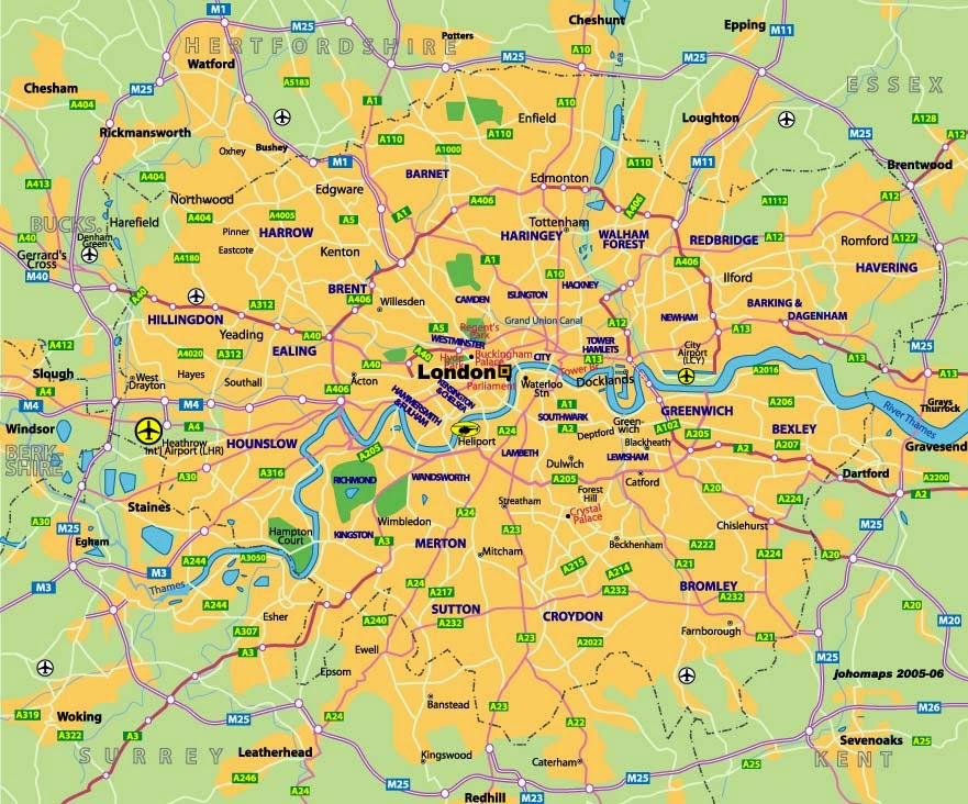
Transport Lines, Stations And Zones
The Tube map is a network diagram. It is designed to make lines, stations and interchanges clear, not to show exact street distance.
That is why two stations that look far apart on the Tube map may be walkable, while two stations that look close may involve awkward roads, river crossings or station entrances. Use the Tube map for movement, then check a street map for walking.
TfL’s Tube map page also links to related resources such as large-print Tube maps, step-free Tube guides, cycle guidance and toilet facilities maps, which shows that the Tube map is only one part of London’s map system.
Boroughs, Neighbourhoods And Central London Areas
A London borough map shows local authority areas. London Councilsdescribes London local government as the 32 boroughs and the City of London Corporation.
A neighbourhood map is different. It shows visitor-friendly areas such as Soho, Mayfair, Camden, Greenwich or Kensington. These names are often more useful for sightseeing, hotels and restaurants than borough boundaries.
Central London is different again. It is a practical visitor idea, not one single fixed line on every official map.
Major Landmarks, Parks, Museums And Visitor Attractions
A London landmarks map usually highlights places such as Big Ben, Buckingham Palace, Tower Bridge, the Tower of London, St Paul’s Cathedral and the British Museum.
Visit London’s attractions map lets users display sights, museums, parks, sightseeing routes, West End shows, afternoon tea and shopping categories, which makes it more useful for planning than a static landmark list.
The River Thames As A Key Orientation Point
The River Thames is one of the easiest lines to use when reading a London map. Many first-time routes make more sense once you understand which sights sit north or south of the river.
Westminster and the West End sit north of the Thames. The London Eye, South Bankand parts of the Tate Modern route sit on or near the south side. This simple north-south view makes central London easier to picture.
What Most London Maps Do Not Show Clearly
Most maps hide at least one important detail. A Tube map may not show walking distance accurately. A tourist map may not show fare zones. A borough map may not show the easiest station. A driving map may not explain whether a charge applies.
Map Legend: Common Symbols And Layers Explained
Always read the legend before making a decision. Symbols can look obvious, but in London they often carry specific transport, access or boundary meanings.
| Symbol or layer | What it usually means |
| Coloured Tube or rail line | A transport route, not a precise street path. |
| Station dot | A stop or interchange; check entrances and accessibility separately. |
| Zone number | A fare area used for many Tube and rail journeys. |
| Wheelchair symbol | A type of step-free access; check the exact TfL meaning. |
| Attraction icon | A visitor's place, not always proof of easy walking distance. |
| River line | The Thames, a useful orientation point and transport route. |
| Borough boundary | A local authority area, not a tourist neighbourhood. |
| Charging boundary | A driving rule area; verify on TfL before entering. |
TfL’s step-free materials show why symbols matter. Its step-free Tube guide explains station access, direction-specific entrances and situations where assistance may be needed.
Translate The Map Into Real Visitor Or Driver Decisions
A map should lead to a decision, not just a location. For visitors, that decision might be “stay near this station,” “walk between these two sights,” or “split this itinerary into two areas.”
For drivers, the decision may involve checking whether a route enters the Congestion Charge, ULEZ or LEZ areas. TfL’s maps hub includes dedicated maps for these driving zones, so a generic tourist map is not enough for compliance decisions.
Drivers should check the London ULEZ boundary mapbefore relying on a generic tourist or street map for route planning.
The Main Types Of London Map And When To Use Each One
London becomes easier when you stop asking for “a map” and start asking what you need the map to decide.
Different maps simplify different parts of the city.
| Map type | Best used for |
| Tube and rail map | Station-to-station planning, lines, interchanges and general direction. Do not rely on it for exact walking distance. |
| Tourist attractions map | Grouping landmarks, museums, parks and visitor areas before building an itinerary. |
| Central London map | Understanding the dense visitor core around Westminster, South Bank, the West End, Kensington and the City. |
| London borough map | Checking official local authority areas, council boundaries, datasets and wider city structure. |
| Neighbourhood and area map | Choosing where to stay, eat, shop or spend an afternoon in areas such as Soho, Mayfair, Camden or Greenwich. |
| Walking, cycling and river maps | Planning routes by foot, bike or boat when the travel mode matters more than the Tube network. |
| Accessible and large-print maps | Checking step-free access, stairs, platform gaps, toilets, large print and other access details. Use official TfL accessibility resources for this. |
London Map Zones Explained
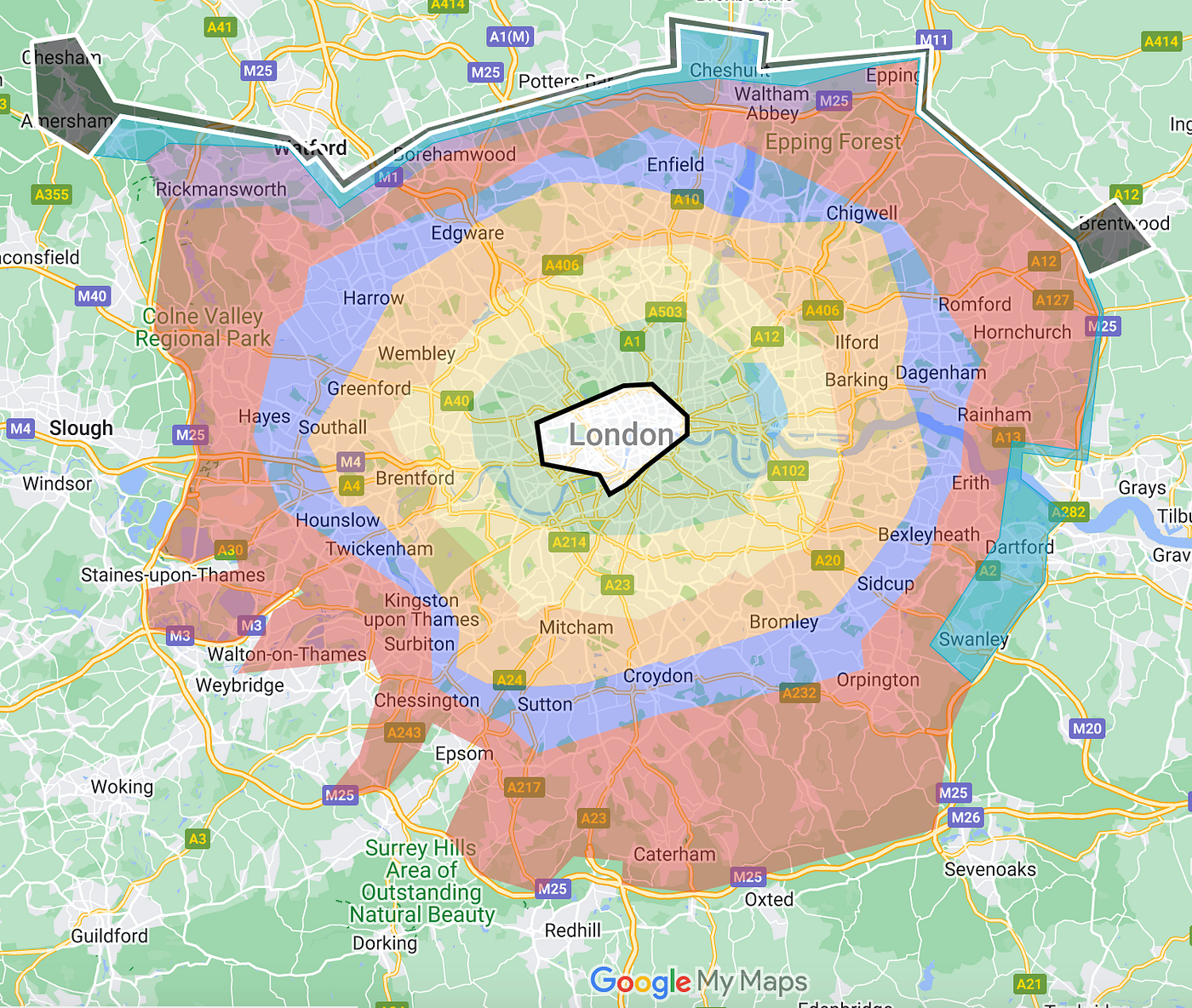
London map zones are one of the most common sources of confusion. They are useful, but only when you understand what they are for.
Zones are mainly a transport concept. They help organise fare and journey planning, but they are not the same as boroughs, neighbourhoods or tourist areas.
What London Transport Zones Mean
London transport zones are fare areas arranged broadly outward from the centre. Zone 1 covers much of the central transport core, with higher-numbered zones extending further out.
For current fare details, TfL should be treated as the authority. The official Tube map directs travellers to TfL’s fare finder for detailed fare checking.
Is Zone 1 The Same As Central London?
Zone 1 is a helpful shortcut for “central enough for many visitor journeys,” but it is not a perfect definition of central London.
Central London can mean different things depending on the context: tourism, local government, transport, hotels, business districts or culture.
Why Zones Matter For Oyster, Contactless And Travelcards
Zones matter because many Tube and rail fares depend on where your journey starts and ends. They can also influence hotel decisions.
A Zone 2 hotel beside a fast, direct station can sometimes be more convenient than a Zone 1 hotel with awkward transfers. The zone is only one part of the decision; connection quality matters too.
London Borough Map Explained
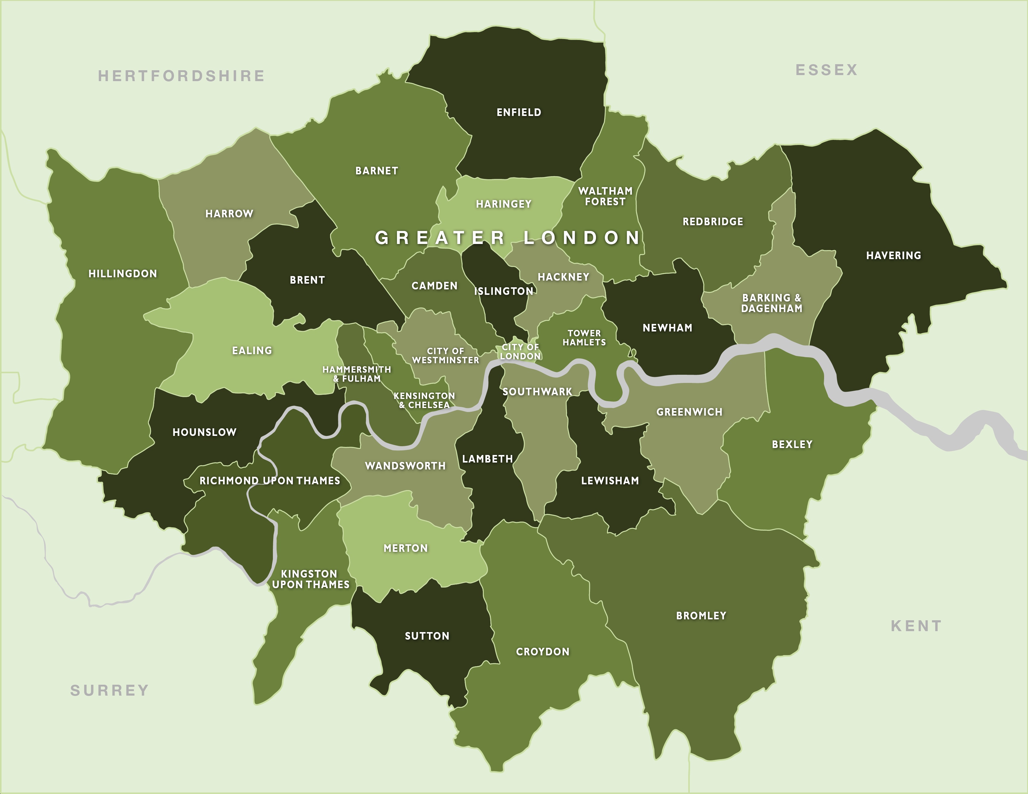
A London borough map answers a different question from a Tube map. It tells you how London is officially divided, not how tourists usually move through it.
This matters because borough names often appear in council services, datasets, planning pages and local information, while visitors usually think in neighbourhoods.
How Many Boroughs Are In London?
London has 32 boroughs plus the City of London Corporation. London Councils uses that same structure when describing London local government.
That wording matters because the City of London is not just another tourist neighbourhood. It has a distinct administrative role.
Why The City Of London Is Different
The City of London is the historic financial district often called the Square Mile. It sits inside the wider metropolis that most people simply call London.
For detailed City-specific information, the City of London Corporation provides its own services and mapping resources. Its role is distinct from the 32 London boroughs.
Boroughs Vs Neighbourhoods Vs Postcodes
These systems often overlap, but they do not mean the same thing.
| Map term | What it means |
| Borough | Official local authority area; useful for councils and boundaries. |
| Neighbourhood | Informal visitor area; useful for hotels, restaurants and sightseeing. |
| Postcode | Address system; useful for finding exact locations. |
| Zone | Transport fare area; useful for Tube and rail cost planning. |
| Central London | Practical visitor core; useful for first-time sightseeing. |
The mistake is treating these systems as interchangeable. A hotel can be in one borough, marketed as a neighbourhood, located in a postcode area and served by a different transport zone.
When A Borough Map Is Useful For Visitors
A borough map helps when you want to understand where an area sits in wider London. It is useful for longer stays, relocation research, local events or comparing outer London areas.
For a short sightseeing trip, a central London map, tourist map and TfL map will usually be more practical.
Central London Map: Where Most First-time Visitors Should Start
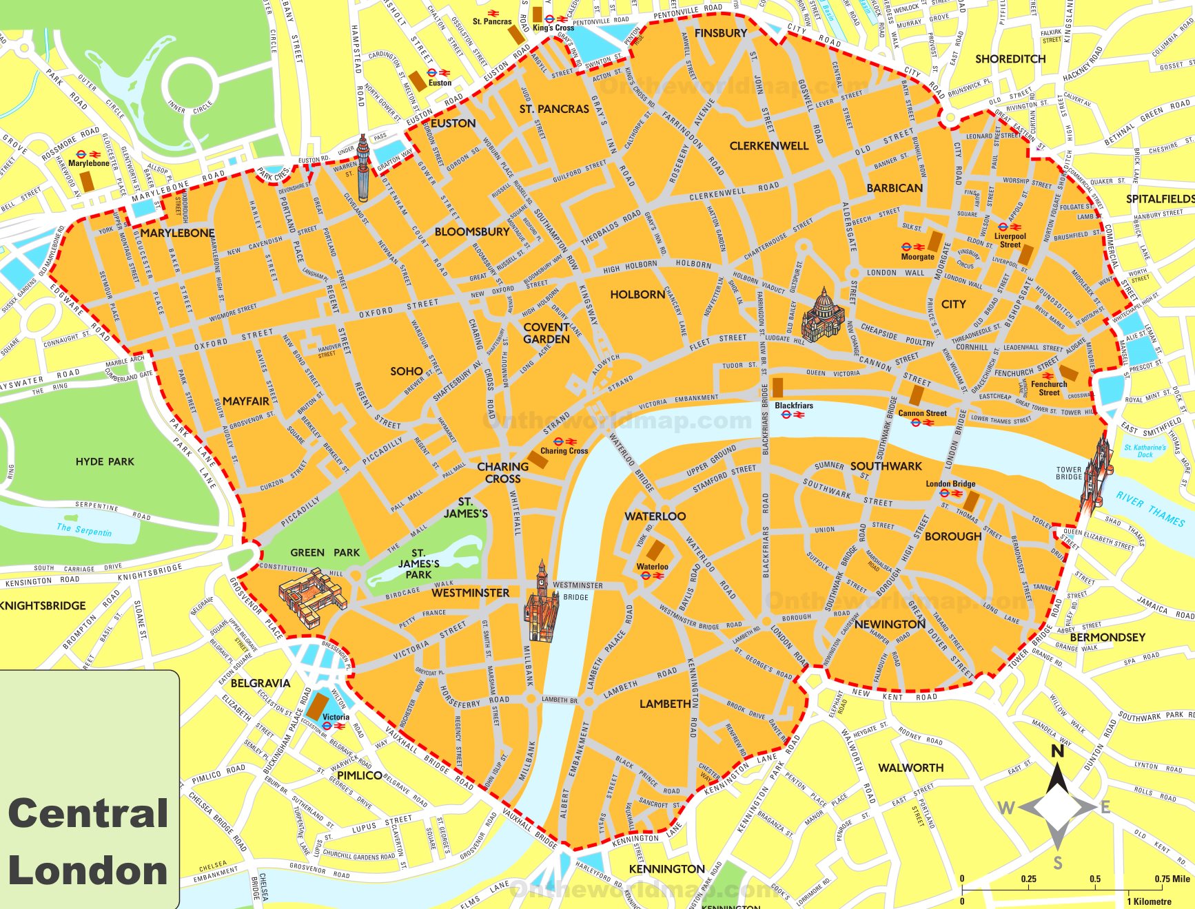
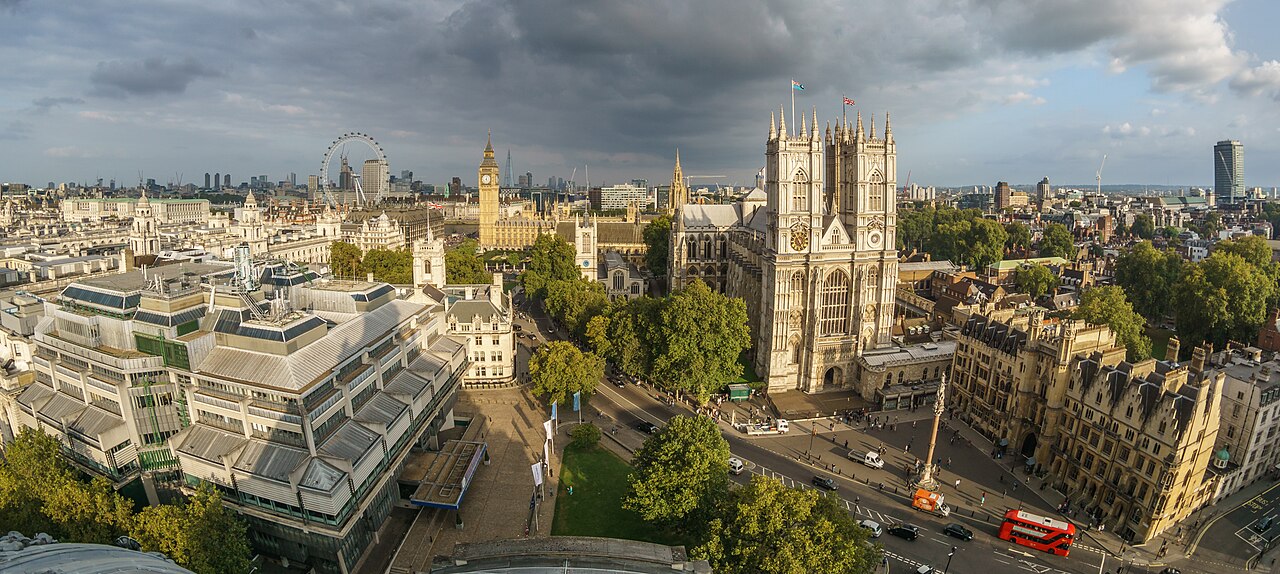
A central London map helps first-time visitors reduce complexity. It shows the dense area where many famous sights, museums, theatres, parks and stations sit close together.
Use it to plan clusters. Instead of crossing the city repeatedly, group nearby places and move through London in sensible sections.
What “central London” Usually Means For Tourists
For visitors, central London usually means the area around Westminster, the West End, South Bank, the City of London, parts of Kensington and major transport hubs.
It is not a single legal boundary. It is a practical way to describe the part of London where many first-time attractions are concentrated.
The River Thames As Your Orientation Line
Use the Thames like a spine through the map. It helps you understand why Westminster Bridge, Waterloo Bridge, Millennium Bridge, London Bridge and Tower Bridge matter.
Once the river makes sense, South Bank and the City of London become easier to connect visually.
Westminster, South Bank, West End And The City
These four areas explain much of central London sightseeing:
- Westminster: Parliament, Big Ben, Westminster Abbeyand Buckingham Palace.
- South Bank: London Eye, riverside walks and cultural venues.
- West End: Soho, Covent Garden, theatres and shopping.
- City of London: St Paul’s, Bank, Monument and Tower of London routes.
This is where a London landmarks map becomes more valuable than a simple list of attractions.
Why Central London Is Not One Fixed Official Boundary
The phrase “central London” changes by context. A hotel page, Tube map, government dataset and tourist map may all draw the idea differently.
For visitor planning, that is not a problem. Use central London as a practical planning zone, not a legal line.
A central London map is the starting layer. The next layer is landmarks by area.
Tourist Map London: Plan Sightseeing By Area, Not By Random Landmarks
A tourist map should stop you from zigzagging across the city. Its real value is showing which places belong together.
The strongest London sightseeing plans are built around clusters: choose an area, add nearby landmarks, then use transport only when the next cluster is too far to walk.
Westminster Cluster: Big Ben, Parliament, Westminster Abbey, Buckingham Palace
This is the classic first-time London cluster. It works well because the landmarks are close enough to understand on a map and often fit into one half-day plan.
A visitor might start near Westminster station, see Parliament and Big Ben, walk to Westminster Abbey, then continue towards St James’s Park and Buckingham Palace.
If your route includes Westminster Abbey, Parliament Square or Big Ben, the live Parliament Square webcamgives you a real-time view of the area before you travel.
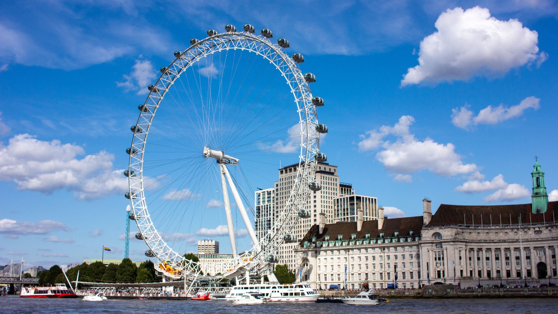
South Bank Cluster: London Eye, Tate Modern, Shakespeare’s Globe, Tower Bridge Route
South Bankis one of the easiest places to understand on foot because the Thames keeps you oriented. It is also where a street or walking map is more useful than a Tube diagram.
A map helps you decide whether to focus on a short London Eye riverside walk or continue east towards Tate Modern, Shakespeare’s Globe and Tower Bridge.
City Of London Cluster: St Paul’s, Bank, Monument, Tower Of London
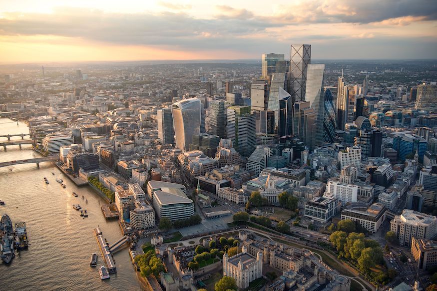
The City of London cluster mixes history, finance and landmark sightseeing. It is compact but dense.
Use a landmarks map for St Paul’s, Monument and the Tower of London, then use TfL if you are connecting onward to Greenwich, Camden or Kensington.
West End Cluster: Soho, Covent Garden, Leicester Square, Piccadilly Circus
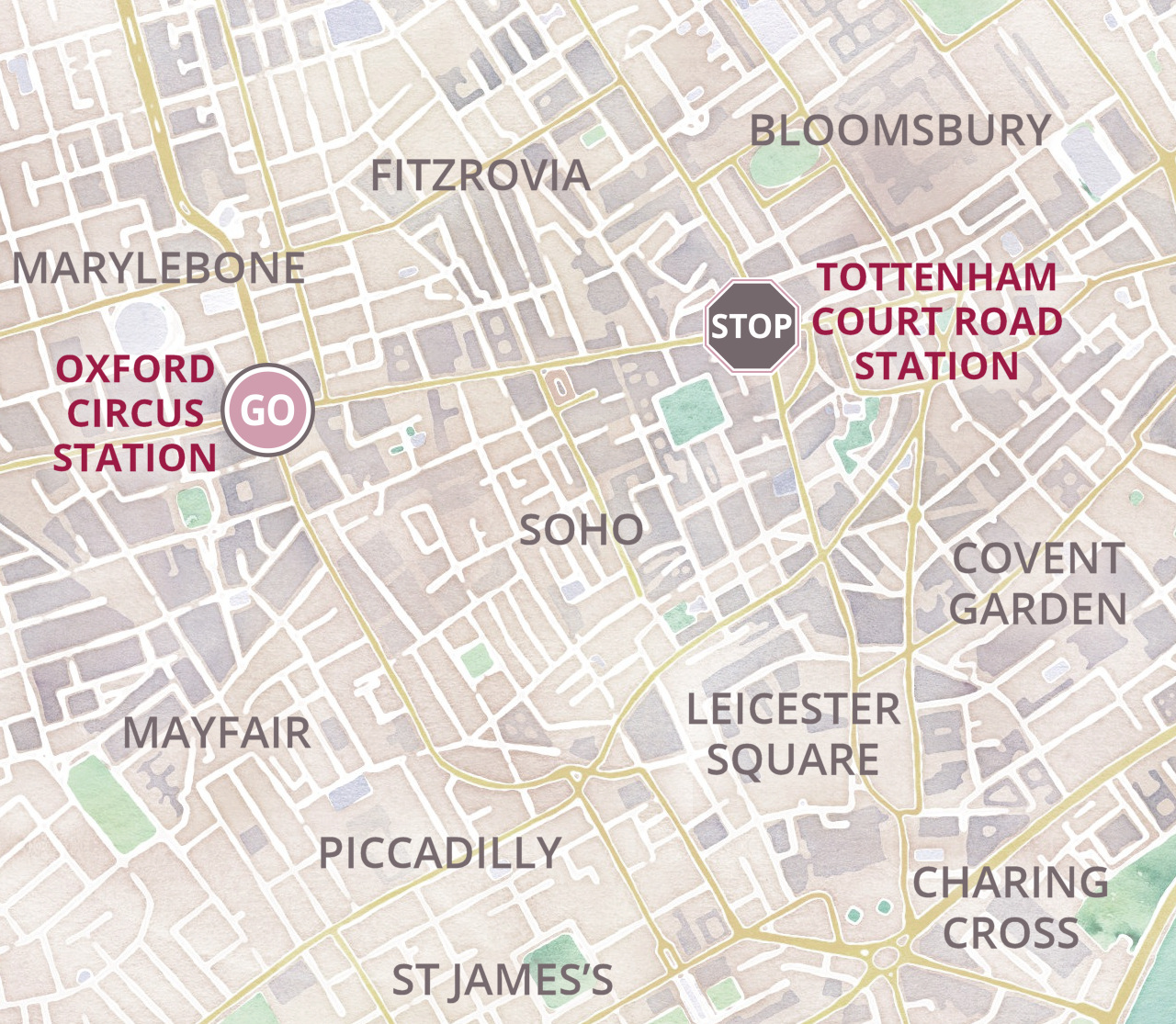
This cluster is about entertainment, food, theatre and shopping. It is easy to overuse the Tube here when walking may be simpler.
A detailed central London map can show that many West End stops are close enough to walk between, especially around Soho, Covent Garden and Leicester Square.
For a live sense of the West End before you go, check the Piccadilly Circus webcamor the Shaftesbury Avenue webcamto see current traffic, crowds and Theatreland activity.
Travel planning note: In central London, check the walking route before taking the Tube for one stop. Walking may be simpler when stations are close and interchanges are awkward.
Kensington Cluster: Museums, Hyde Park, Kensington Gardens
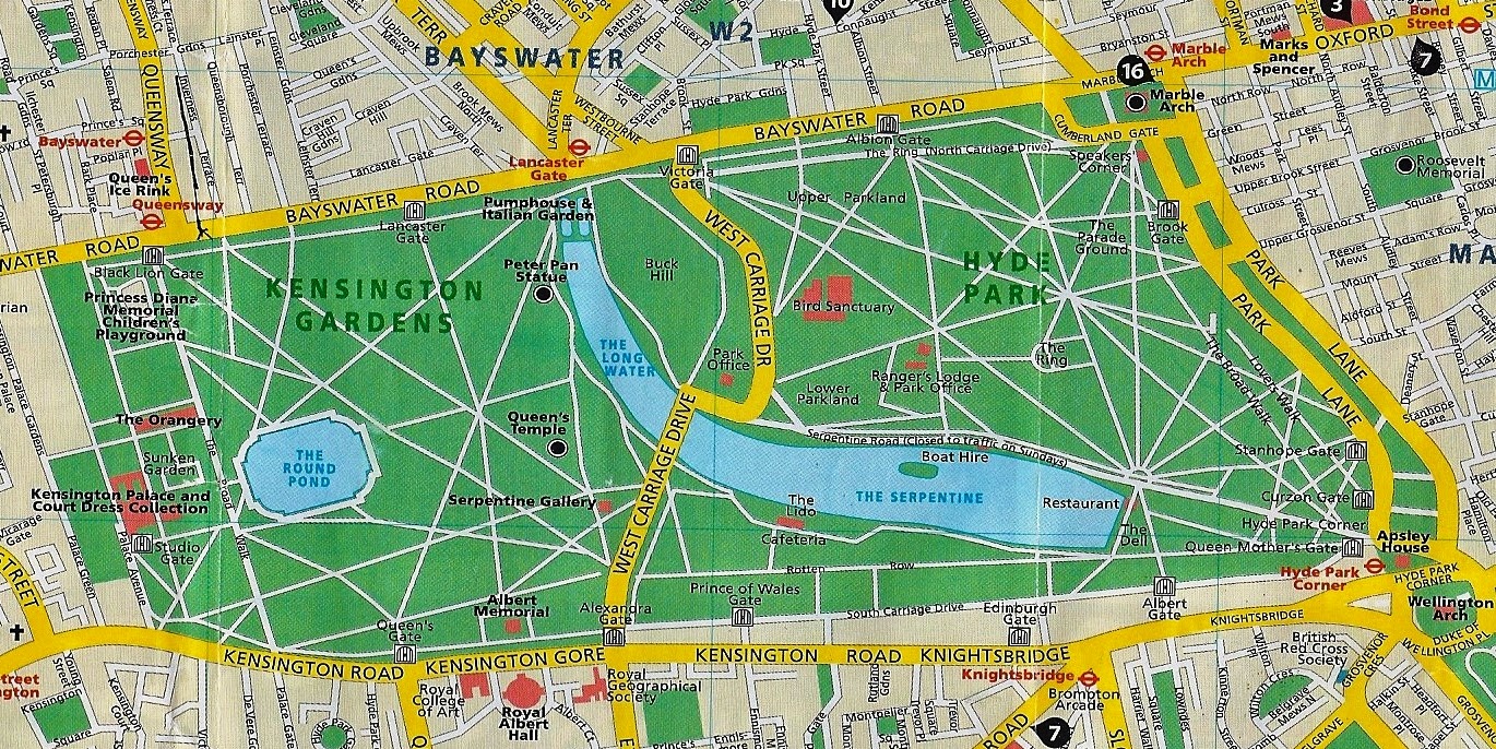
Kensington works well as a museum and park cluster. The Natural History Museum, Science Museum, Victoria and Albert Museum, Hyde Park and Kensington Gardens are often planned together.
A map helps you avoid mixing this cluster with faraway east London sights on the same rushed day.
Greenwich Cluster: Cutty Sark, Royal Observatory, Maritime Greenwich
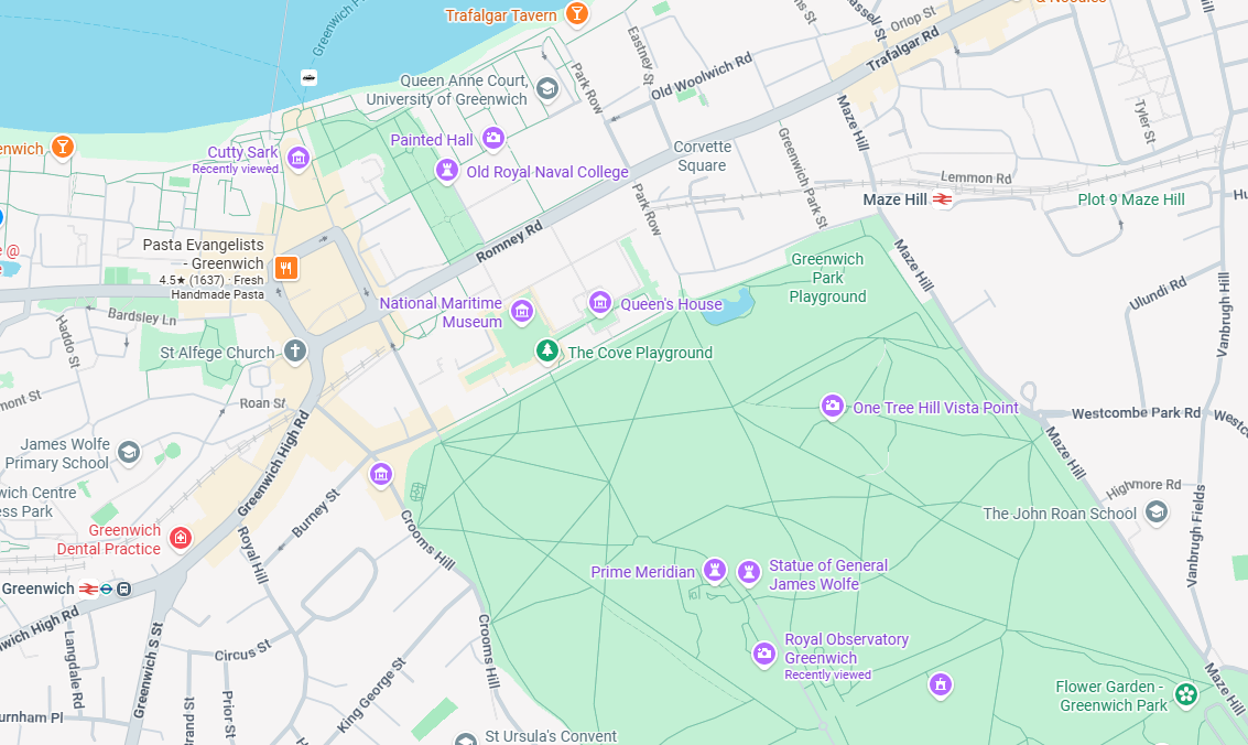
Greenwich sits away from the central core, so it benefits from its own plan. A tourist map helps you understand the local sights; a TfL map helps you decide how to get there.
This is a good example of using two maps: one for the journey and one for the area.
Camden And Regent’s Park Cluster
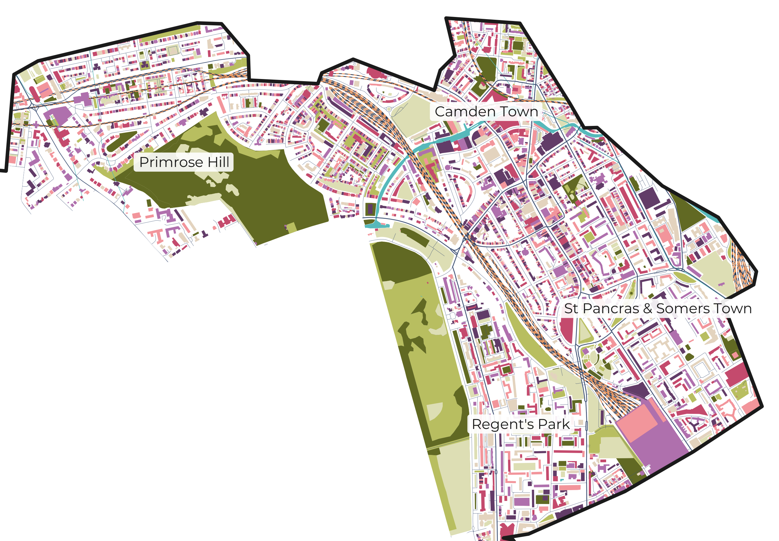
Camden works well with Regent’s Park, London Zoo or canal-side walking, depending on your interests.
A neighbourhood map is especially useful here because the experience is less about one monument and more about markets, streets and atmosphere.
Mayfair And Shopping Areas
Mayfairsits near Hyde Park, Green Park, Piccadilly and Oxford Street. It is useful on a map because it connects luxury hotels, galleries, shopping streets and nearby royal parks.
Mayfair and Soho are close, but they support different visitor plans. A map helps you see the difference before you build your day.
The strongest tourist map does not make London smaller. It makes your day more coherent.
London Landmarks Map: Six Famous Places And Where They Sit
A London landmarks map is most useful when it shows relationships, not just pins. The aim is to understand which famous places can be seen together.
Six common first-time anchors are Big Ben, Buckingham Palace, Tower Bridge, the Tower of London, the British Museum and St Paul’s Cathedral.
Big Ben And The Houses Of Parliament
Big Ben and the Houses of Parliament sit in Westminster beside the Thames. On a map, they pair naturally with Westminster Abbey, Westminster Bridge, St James’s Park and Buckingham Palace.
This is one of the clearest examples of sightseeing by cluster.
Buckingham Palace
Buckingham Palacesits west of Westminster and close to St James’s Park, Green Park and The Mall. A central London map helps you judge whether to walk from Westminster or arrive via nearby stations.
If you are already in Westminster, check the walking route before choosing the Tube.
Tower Bridge
Tower Bridge sits east of the main Westminster and South Bank core. It pairs well with the Tower of London, the City, London Bridge and river walking.
A visitor map helps you see the landmark relationship; a TfL map helps if you are coming from the West End or Kensington.
Tower Of London
The Tower of London is close to Tower Bridge and the City of London. It makes more sense on a map when grouped with river and City sights.
Avoid pairing it randomly with Kensington museums unless you have a clear transport plan.
British Museum
The British Museum sits near Bloomsbury, north of Covent Garden and the West End. It pairs well with Soho, Covent Garden, Oxford Street or Russell Square.
A central map helps here because the nearest Tube station is not the only factor. Walking routes can be practical.
St Paul’s Cathedral
St Paul’s sits in the City of London, close to Millennium Bridge and within reach of Tate Modern across the river.
On a map, it can bridge the City and South Bank clusters, making it useful for a mixed walking route.
A landmarks map becomes powerful when it turns famous names into sensible sequences.
How To Use The Map For Planning
A strong London plan usually uses three layers: a tourist map for attraction clusters, a TfL map for transport, and a street or app map for walking details.
This section turns the map into practical decisions about where to stay, what to see, how to move and what to verify.
Start With Your Purpose: Transport, Sightseeing, Accommodation Or Walking
Do not start with the prettiest map. Start with the question.
- “How do I travel?” needs a TfL map.
- “What is nearby?” needs a tourist map.
- “Where should I stay?” needs a central London and transport map.
- “Can I avoid stairs?” needs an accessibility map.
- “Will I drive into a charging zone?” needs a TfL driving-zone map.
Group Attractions By Area Before Building An Itinerary
Pick one cluster first. Westminster and South Bank pair well. Kensington museums deserve their own block. Greenwich often works well as a separate half-day or day plan.
This reduces wasted transport time and makes the city feel more manageable.
Download Or Print Backup Maps Before Travelling
A saved or printed map is useful when mobile signal, battery or roaming data becomes unreliable. Visit London provides free official map resources, printables and app guides for visitors.
For accessibility, save the exact TfL map that matches the need, such as step-free access or large print.
Check Live Route Updates Before Relying On A Static Map
A static map can show the network design, but it cannot guarantee the journey conditions at your travel time.
Use maps to plan the shape of the journey, then check official live information before you leave.
Pro tip: check live conditions before you go.Use maps to plan the shape of your journey, then check official live information before you leave. For visible central London conditions, you can also check our live London webcamsto see weather, traffic and street crowds before setting off.
How To Use This Map
- Identify the map source first.
- Read the legend before interpreting symbols.
- Decide whether you need transport, landmarks, areas or boundaries.
- Compare the map with your start point.
- Check live details for transport, access or driving rules.
A map is most useful when it leads to a next step.
Practical Examples
These examples show how map choices change real travel decisions. They are planning patterns, not promises about journey times or costs.
Example 1: Planning A First-time Sightseeing Day In Westminster And South Bank
Start with a tourist map and select Westminster, the Thames and South Bank. The map shows that Parliament, Big Ben, Westminster Abbey, the London Eyeand riverside walking sit close together.
Then use TfL only for reaching the starting point and leaving the area. This avoids turning a walkable sightseeing cluster into a station-hopping day.
Example 2: Choosing Between A Zone 1 Hotel And A Zone 2 Hotel
A Zone 1 hotel may look more central, but the better choice depends on connections. A Zone 2 hotel beside a fast, direct station can sometimes be more practical than a Zone 1 hotel with awkward transfers.
Use a zone map for fare awareness, a Tube map for connections and a tourist map for attraction distance.
If you are comparing hotel areas, guide to best neighborhoods to stay in Londoncan help you match your base to transport, budget and trip style.
Example 3: Using A Borough Map To Understand Where An Area Sits
If you are researching Greenwich, Camden or Kensington, a borough map helps you place the area in wider London. It can explain official context, but it will not tell you which street feels most useful for a visitor walk.
Use borough maps for structure, then switch to tourist or neighbourhood maps for planning.
Example 4: Combining A Landmarks Map With TfL For A Museum Day
For a Kensington museum day, use a landmarks map to group the Natural History Museum, Science Museum, V&A and nearby parks. Then use TfL to plan your route to South Kensington or another nearby station.
The landmarks map builds the day; the transport map gets you there.
Example 5: Planning An Accessible Route Using Official TfL Maps
For accessible travel, start with TfL’s step-free or large-print resources rather than a generic map. TfL’s step-free Tube guide is designed to show stations with step-free access and details that can affect the journey.
Then check current station status before travel, because a saved map cannot show every temporary change.
Accessible travel note: If step-free access is essential, do not rely on a standard Tube map screenshot. Use TfL’s accessibility map and check the current station information before leaving.
Common Misunderstandings
Most London map errors happen because people mix up systems that look similar on the page.
Once you separate those systems, the map becomes much easier to use.
London Zones Are Not The Same As Boroughs
Zones are transport fare areas. Boroughs are local government areas. They may overlap visually, but they are built for different purposes.
A zone helps with a journey. A borough helps with official area context.
Central London Is Not One Fixed Official Boundary
Central London is a practical phrase. It may mean the visitor core, the business core, Zone 1 or a broader inner-London area depending on the source.
When planning a trip, define it by purpose: landmarks, hotels, transport or walking distance.
The Tube Map Is Not Geographically Accurate
The Tube map is designed to simplify the network. It helps you understand lines and interchanges, not exact distances or street positions.
Always check a walking or street map before assuming two places are too far apart to walk.
The City Of London Is Not The Same As Greater London
The City of London is a specific historic and administrative area within wider London. Greater London includes the 32 boroughs plus the City of London Corporation.
This matters when a map labels “City” or “City of London.”
A Tourist Map Is Not Enough For Live Transport Planning
A tourist map can show where the landmarks are. It cannot replace live route planning, station status, current fares or service updates.
Common Mistakes
- Treating Zone 1 as the only area worth staying in.
- Assuming every Tube station is easier than walking.
- Ignoring the map legend.
- Using outdated screenshots from search results.
- Confusing boroughs with neighbourhoods.
- Planning one day across too many distant clusters.
- Using a tourist map for driving-zone decisions.
Map mistake to avoid: Do not plan a full day from a landmark list alone. Put the landmarks on a map first, then group them by area.
Official London Maps To Download Or Use
Official maps should come first when the information affects travel, access, boundaries or driving compliance.
Third-party maps can still be helpful for inspiration, but official sources should anchor the facts.
TfL Maps For Tube, Bus, Rail, River And Cycle Travel
TfL is the primary source for London transport maps. Its official maps hub includes Tube and rail, bus, cycle, river, Congestion Charge, ULEZ, LEZ, red routes and Oyster Ticket Stop maps.
For Tube-specific planning, use TfL’s Tube map page and related accessibility resources.
Visit London Maps For Attractions And Visitor Planning
Visit London is the official visitor guide and provides free travel maps, app guidance and attraction-map tools. Its attractions map is especially useful for filtering sights, parks, museums, routes and visitor experiences.
Use it for deciding what belongs together on a sightseeing day.
London Datastore And Borough Boundary Sources
Use official London data sourceswhen borough boundaries matter. A borough dataset is more reliable for boundary context than a simplified visitor map.
For everyday sightseeing, though, do not let borough boundaries overcomplicate the plan. Visitors usually need neighbourhoods, stations and landmark clusters first.
City Of London Maps For The Square Mile
Use City of London Corporation resources when your question is specifically about the Square Mile.
This is useful for City-specific services, local context and boundary information.
Third-party Maps: When They Are Useful And When To Be Cautious
Third-party tourist maps can be helpful for visual inspiration, walking ideas and neighbourhood orientation. They should not be your only source for transport, accessibility, fares, road charging or official boundaries.
Use them as a planning aid, not as the final authority.
Useful Apps And Digital Maps For Getting Around London
Digital maps are useful because they can combine location, routing and saved places. They still need source awareness.
TfL Go
For official London transport planning, TfL Go should usually be your first transport app because it comes from Transport for London.
It is useful when your task involves Tube, rail, station access or current transport planning.
Google Maps
Google Maps is useful for walking, business locations, saved places and point-to-point routing. It is especially helpful once you already know the neighbourhood or landmark cluster.
Do not use it as a replacement for official TfL accessibility or driving-zone guidance when those details matter.
Visit London App
Visit London’s appis useful for visitor ideas, itineraries and top sights, with map-based browsing. Visit London says its app can help users create sightseeing maps and itineraries.
It is most useful for sightseeing inspiration rather than technical transport rules.
Offline Maps And Printed Backup
Offline maps protect you from low battery, poor signal or roaming issues. A printed central London map can still be useful for quick orientation.
For accessibility or transport, save the latest official TfL map that matches the need.
Accessible London Maps
Accessibility is not just about whether a station has a symbol. It is about what that symbol means for the whole journey.
Step-free Tube Map
TfL’s step-free resources help travellers understand which stations offer step-free access and what the journey may involve. The official step-free Tube guide includes DLR and London Overground information and gives route-specific notes.
This can matter for wheelchair users, travellers with buggies, heavy luggage or mobility concerns.
Large-print Tube Map
TfL provides large-print Tube maps for travellers who need a more readable version of the standard Tube map. The standard Tube map also directs users to the step-free guide for more detailed accessibility information.
Use these resources instead of zooming into a low-quality screenshot.
Toilet And Facility Maps
TfL’s Tube map resources include toilet facilities information. This can be useful for families, older visitors and travellers planning longer cross-city days.
Facilities are part of real journey planning, not an afterthought.
Accessibility Caveat: Always Check Station Status Before Travel
Accessibility information can change because lifts, escalators and station arrangements may be temporarily unavailable.
Use the map to shortlist a route, then confirm current conditions before travelling.
How To Plan A London Sightseeing Day With Maps
The aim is to stop London feeling like a long list and start seeing it as connected clusters.
This method works because it starts with geography before transport.
Step 1: Choose Your Main Area
Pick one main area for the day: Westminster, South Bank, Kensington, the City, Greenwich, Camden or the West End.
This immediately reduces the number of transport decisions.
Step 2: Add Nearby Landmarks
Use a tourist or landmarks map to add places that sit close together. Do not add a famous sight just because it is famous.
A good day has a logical shape on the map.
Once you have chosen your main area, compare nearby places to visit in Londonby area before adding anything far across the city.
Step 3: Check Walking Distances
Use a street map or app to check walking routes. The Tube map may make two places look further apart than they are.
This is especially important in the West End, Westminster and South Bank.
Step 4: Use TfL For Cross-city Journeys
When the next cluster is too far to walk, switch to TfL. Use the Tube, rail, bus or river map that matches the journey.
Check current conditions before leaving, especially at busy times or when accessibility matters.
Step 5: Keep One Backup Map Offline
Save a central London map, your main TfL map and any accessibility map you need. A backup is most useful when the day changes.
London Map FAQs
What Do Visitors Usually Misunderstand?
Visitors often confuse zones with boroughs, central London with Zone 1, and the Tube map with a geographically accurate street map. These systems overlap, but they are not the same.
What Are The 4 Parts Of London?
People often describe London broadly as north, south, east and west London. For visitor planning, it is usually more useful to think in areas such as Westminster, South Bank, West End, the City, Kensington, Camden and Greenwich.
What Are 6 Famous Places In London?
Six famous London places are Big Ben, Buckingham Palace, Tower Bridge, the Tower of London, the British Museum and St Paul’s Cathedral. A landmarks map helps you group them into practical sightseeing clusters.
How Many Cities Are In London, UK?
Greater London includes the City of London and the City of Westminster, but visitors should usually plan by areas, stations and landmarks.
Which Part Of The UK Is London In?
London is in southeast England and sits on the River Thames. It is the capital of England and the United Kingdom.
Which London Map Is Best For Tourists?
For most tourists, use a London attractions mapfor sights and an official TfL map for transport. Visit London’s attractions map is useful for landmarks, museums, parks, routes and visitor experiences.
What Is The Difference Between Zones, Boroughs And Central London?
Zones are transport fare areas, boroughs are local government areas, and central London is a practical visitor term for the dense inner sightseeing core.
Which Apps Or Maps Are Easiest For Getting Around?
Use TfL Go for official London transport planning, Google Maps for walking and saved places, and Visit London resources for visitor ideas. Check official TfL information for current transport and access details.
How Should You Plan Sightseeing By Area?
Choose one area first, add nearby landmarks, check walking distance, then use TfL only when moving between clusters. This prevents unnecessary cross-city travel.
Where Can I Download A Free London Tube Map?
Use TfL’s official Tube map resources or Visit London’s official map pages. TfL also provides related map resources such as step-free and large-print maps.
Can I Print London Maps?
Yes. Visit London provides free official map resources and printables, while TfL provides downloadable maps for Tube, rail, accessibility and other transport needs.
Final Guidance
A London map is only useful when you know what decision it is meant to support. Use a Tube or rail map to move, a tourist map to group sights, a borough map to understand official boundaries, and an accessibility map when step-free or large-print information matters.
For most visitors, the most useful setup is not one perfect map. It is a small stack: Visit London for attractions, TfL for transport, a central London map for orientation, and an offline backup for the day itself.
Treat the map as a planning tool, not just an image. Read the legend, check the source, group your day by area, and verify current details before you travel.
Jump to
Quick Answer: Which London Map Do You Need?
Map Summary: What A London Map Actually Means
What The Map Shows
The Main Types Of London Map And When To Use Each One
London Map Zones Explained
London Borough Map Explained
Central London Map: Where Most First-time Visitors Should Start
Tourist Map London: Plan Sightseeing By Area, Not By Random Landmarks
London Landmarks Map: Six Famous Places And Where They Sit
How To Use The Map For Planning
Practical Examples
Common Misunderstandings
Official London Maps To Download Or Use
Useful Apps And Digital Maps For Getting Around London
Accessible London Maps
How To Plan A London Sightseeing Day With Maps
London Map FAQs
Final Guidance

James Rowley
Author
James Rowley is a London-based writer and researcher covering London life, cultural geography, London travel, live London webcam pages and selected public figures across entertainment, sport, business and public life.
For over 15 years, he has focused on verified sources, first-hand local context and clear explanations that help readers understand both places and people more deeply. His work combines street-level London knowledge with careful research into career credits, media work, business interests and, where relevant, transparently explained net worth estimates.
He writes and reviews articles published on LondonWebcam.
Latest Articles
Popular Articles