London Walking Routes: Best Self-Guided Walks By Time & Interest
Find the right London walking routes for your trip, with official trails, self-guided walks, distances, walking times and practical route choices.
Author:James RowleyAug 24, 2026
Quick Answer: Which London Walk Should You Choose?
The best London walk depends mainly on how much time you have and what you want to see. The practical choice depends on three things: how much time you have, what you want to see and how far you want to walk.
London's official Walk London Networkprovides the backbone for longer walks, while shorter self-guided walks let you target landmarks, parks, canals, neighbourhoods, architecture or riverside scenery without committing to a long-distance trail.
| What you want from your walk | Best route |
| First-time sightseeing | Westminster → South Bank → Tower Bridge |
| Famous London landmarks | Jubilee Walkway or the central Thames |
| Royal London and parks | Westminster → St James's Park → Buckingham Palace → Hyde Park |
| History | Westminster, Greenwich or St Paul's and the City |
| Canals and waterways | Little Venice → Camden → King's Cross |
| Parks and nature | Hampstead Heath, Richmond Park or Green Chain |
| Wildlife and woodland | Epping Forest Big Walk or a Capital Ring section through Richmond Park |
| East London | Lea Valley, Green Link Walk or The Line |
| Architecture | St Paul's and the City |
| Village atmosphere and views | Blackheath → Greenwich |
| Quieter riverside walking | Hammersmith → Barnes → Chiswick |
| Modern and historic London together | Canary Wharf → Greenwich |
| Family-friendly walking | Battersea Park, South Bank or Greenwich |
| Public art and culture | The Line |
| A full-day woodland escape | Epping Forest Big Walk |
| Long-distance walking | Capital Ring, London LOOP or Thames Path |
Most self-guided walks are free to walk. Your main costs are usually transport, food and any attractions you choose to enter.
The key idea:there is no single best London walk. There is a best walk for the day you have planned.
How These London Walking Routes Were Chosen
The routes in this guide were selected for clear experiences, practical public-transport access and a useful fit for different amounts of time and interests.
Official route distances and route information are checked against the organisation responsible for each trail. Shorter visitor walks in this guide are practical self-guided route combinations, not official named trails unless stated otherwise.
How To Choose A London Walking Route That Fits Your Day
Start with the experience you want rather than a route name. A visitor with 90 minutes and a long list of landmarks should not choose the same walk as someone looking for woodland, wildlife or a full-day challenge.
Think about four things before setting off:
Time:For 60–90 minutes, choose one compact area or park. For 2–3 hours, choose one of the main self-guided routes. For half a day, combine a longer route with food or attractions. For a full day, use a section of an official long-distance trail or the Epping Forest Big Walk.
Interest:Landmarks, royal history, museums, canals, parks, wildlife, architecture, public art and riverside scenery all point towards different routes.
Transport:Linear walks are easiest when the start and finish both have straightforward public transport connections. TfL's Walk London Network is specifically designed around this principle.
Flexibility:A good visitor route should have logical points where you can stop, shorten the walk or continue if you still have time.
Best London Walk For First-time Visitors
It gives you a high concentration of recognisable London sights, while the Thames provides a simple visual navigation line. You can see Westminster Abbey, Big Ben and the Houses of Parliament, cross Westminster Bridge, continue past the London Eyeand Southbank Centre, and then work east towards Tate Modern, Shakespeare's Globe, Borough Market and Tower Bridge.
You can stop at London Bridge or continue to Tower Bridge, so the route adapts easily to your schedule.
Other Good Choices By Interest
History:Choose Westminster for political and royal history, Greenwich for maritime history, or St Paul's and the City for historic streets and architectural layers.
Parks and nature:Choose Hampstead Heath for views and woodland, or Green Chain or Capital Ring sections for greener outer London.
Canals and waterways:Choose Little Venice → Camden → King's Cross for a classic canal walk, or the Lea Valley Walk for a longer, less tourist-focused waterway route.
East London and public art:Choose the Lea Valley, Green Link Walk, Jubilee Greenway, The Line or Greenwich for waterways, parks, modern architecture, industrial heritage and public art.
Family-friendly:South Bank, Greenwich and Battersea Park are flexible choices because they combine open space, food, attractions and transport with easy ways to shorten the walk.
The 8 Official Walk London Routes
TfL's Walk London Network is the most useful starting point for understanding London's major walking routes. The network is designed around sections, maps and public-transport access, making long routes more practical for ordinary visitors.
TfL provides maps and written directions for sections and also points walkers towards digital navigation tools.
| Official route | Distance / Approx. walking time |
| Capital Ring | 78 miles / 126 km · ~26 hours |
| Green Chain | 50 miles / 82 km · ~17 hours |
| Green Link Walk | 15 miles / 24 km · ~5 hours |
| Jubilee Greenway | 37 miles / 60 km · ~12–13 hours |
| Jubilee Walkway | 15 miles / 24 km · ~5 hours |
| Lea Valley Walk | 15.6 miles / 24.8 km · ~5 hours |
| London LOOP | ~150 miles / 242 km · ~50 hours |
| Thames Path - London section | 79.5 miles / 128 km · ~26.5 hours |
Time note:These are approximate moving times calculated at roughly 3 mph / 4.8 km/h. Real outings take longer because of crossings, navigation, photographs, food, attractions and other stops. Check the current official route map before setting out, as route details can change.
Capital Ring
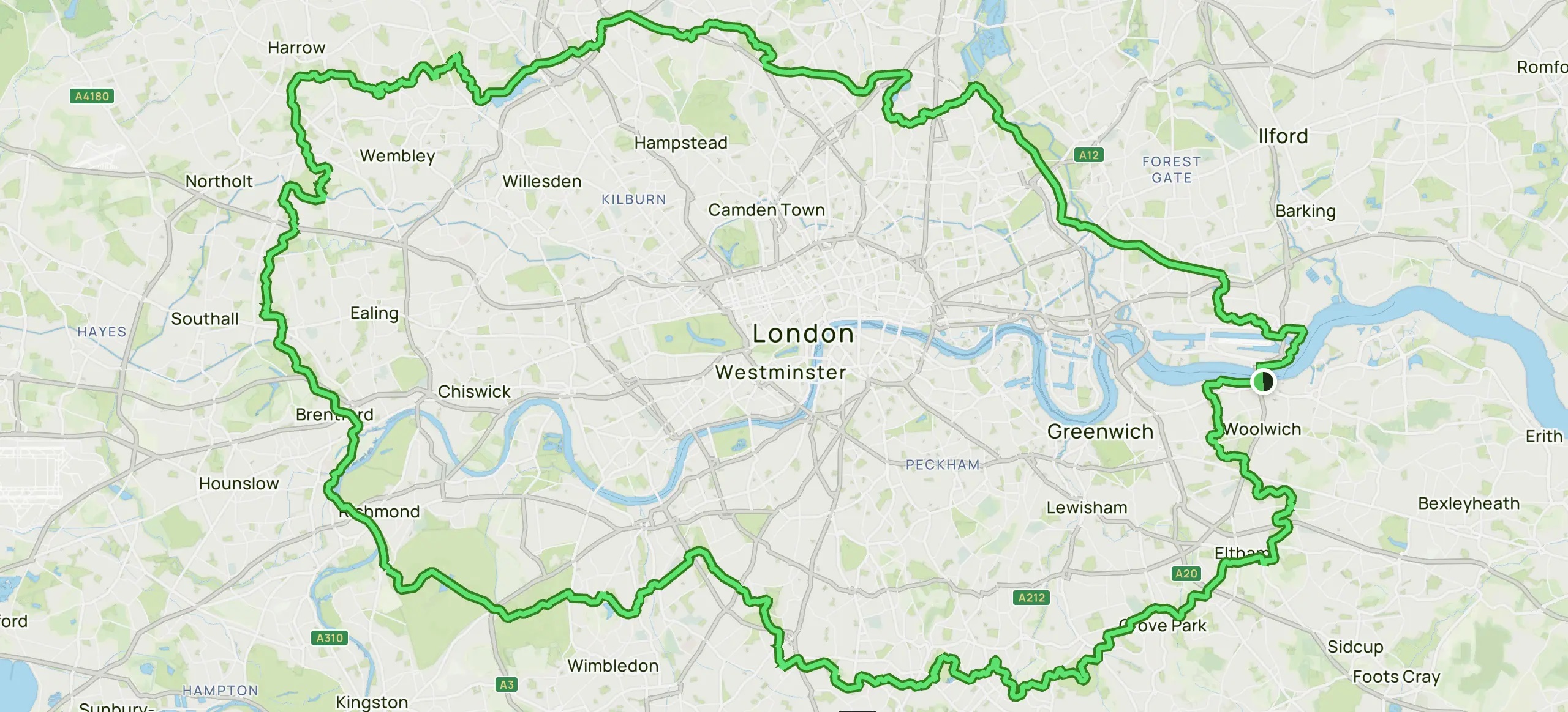
- Best for:green outer London, parks and longer walks
- Distance:78 miles / 126 km
- Approx. walking time:~26 hours
- Total sections: 15
- Typical visitor approach:1 section at a time
- Official route information:TfL Capital Ring
The Capital Ring is a 78-mile orbital route divided into 15 shorter walks. TfL highlights sections through areas including Richmond Park, Wimbledon, Crystal Palace Park and Eltham Palace.
Visitor tip:Choose a section near where you are staying and treat the route as a collection of day walks rather than a 26-hour continuous hike.
Green Chain
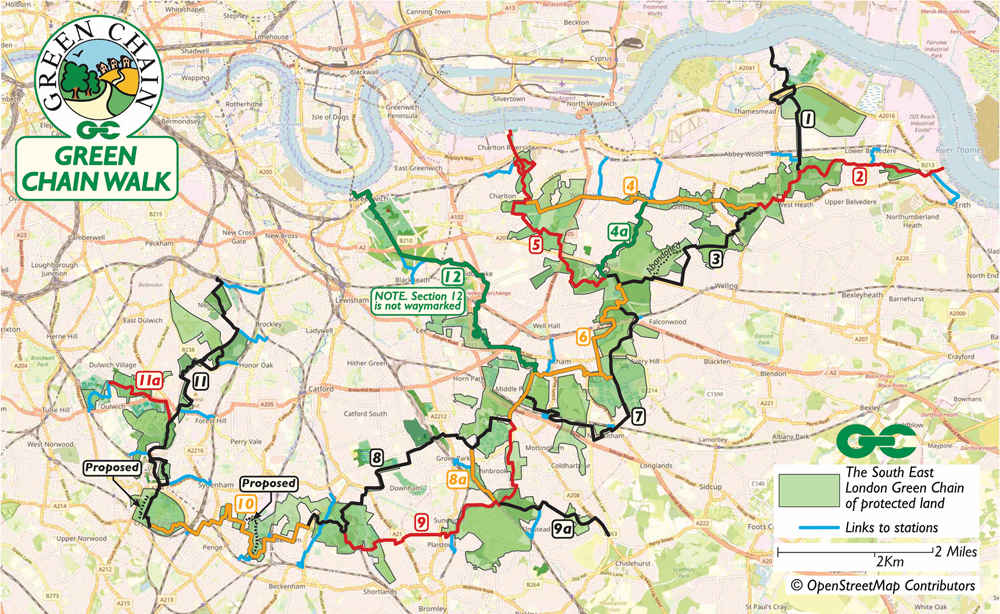
- Best for:parks, woodland and southeast London
- Distance:~50 miles / 82 km
- Approx. walking time:~17 hours total
- Total sections: 11
- Typical visitor approach:1 section or linked sections at a time
- Official route information:TfL Green Chain
The Green Chain is a network of linked walks across southeast London, taking in numerous woods, parks and open spaces. TfL highlights places including Crystal Palace and Oxleas Woods.
Visitor tip:Choose a section that links green spaces you specifically want to visit rather than attempting the full network.
Green Link Walk
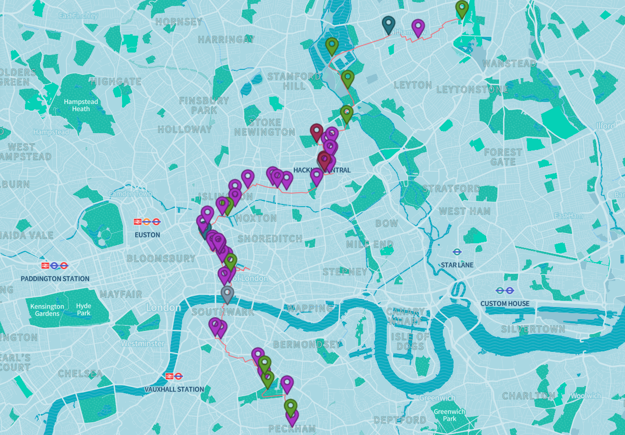
- Best for:connecting green spaces across East, central and southeast London
- Distance:~15 miles / 24 km
- Approx. walking time:~5 hours total
- Total sections: 4
- Typical visitor approach:Full route in a long day or split into shorter sections
- Official route information:TfL Green Link Walk
The Green Link Walk connects nearly 40 green spaces, waterways and other Walk London routes between northeast and south London. It was launched in March 2024 and was designed to connect existing green spaces rather than simply create another central sightseeing loop.
Visitor tip:Choose a section around Walthamstow Wetlands, Hackney or Burgess Park according to whether you want nature, neighbourhood walking or green space. Check the current official map before setting out because route details can change.
Jubilee Greenway
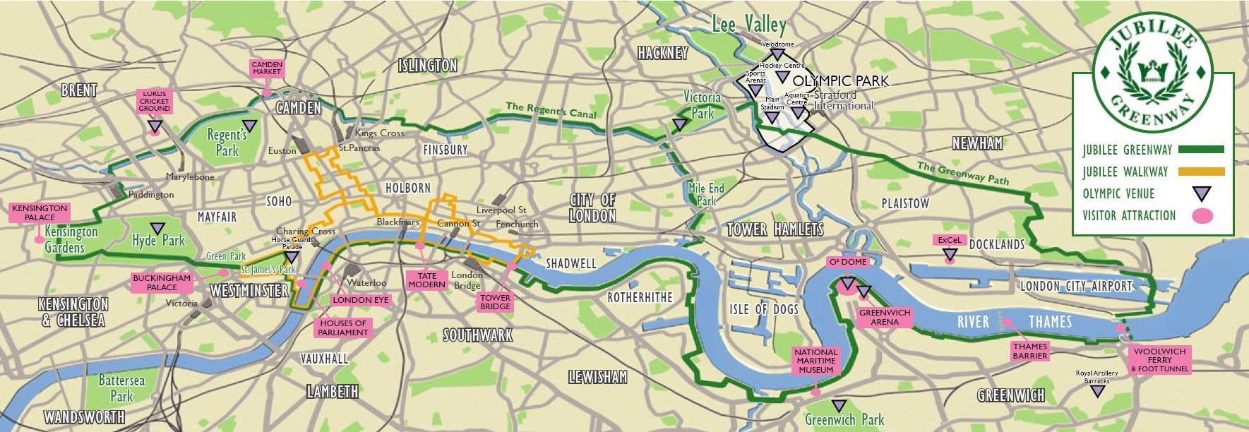
- Best for:major London landmarks, parks, waterways and Olympic-era sites
- Distance:~37 miles / 60 km
- Approx. walking time:~12–13 hours total
- Total sections: 10
- Typical visitor approach:Selected sections
- Official route information:TfL Jubilee Greenway
The Jubilee Greenway was created around Queen Elizabeth II's Diamond Jubilee and the London 2012 Games. TfL highlights links between places including the O2, Greenwich Park and other major London locations.
Visitor tip:Choose a section around the attractions you already plan to visit rather than treating all 37 miles as a single sightseeing walk.
Jubilee Walkway
- Best for:central London sightseeing
- Distance:~15 miles / 24 km
- Approx. walking time:~5 hours total
- Total sections: 5
- Typical visitor approach:1 or 2 circular sections at a time
- Official route information:TfL Jubilee Walkway
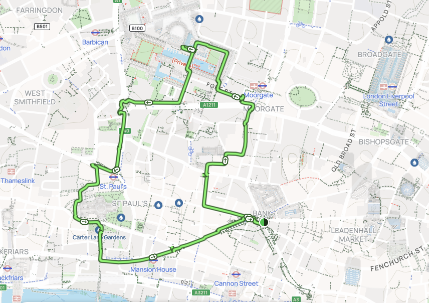
The Jubilee Walkway is a 15-mile central walking trail split into five circular sections. TfL describes it as a route through major London landmarks including St Paul's, Buckingham Palace, Sir John Soane's Museum and Tower Bridge.
For visitors, the practical advantage is that you can choose a single loop rather than treating the whole 15 miles as one walk.
Useful visitor sections:
- City Loop:roughly 2 miles / about 1 hour, for St Paul's, the Barbican and the historic City.
- Jubilee Loop:roughly 2 miles / about 1 hour, for Westminster, St James's Park and the Houses of Parliament.
Lea Valley Walk
- Best for:waterways, wetlands and East London
- Distance:~15.6 miles / 24.8 km
- Approx. walking time:~5 hours total
- Total sections: 6
- Typical visitor approach:1 section or selected stretch
- Official route information:TfL Lea Valley Walk
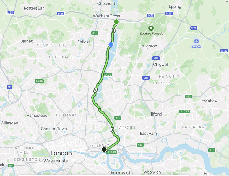
The Lea Valley Walk follows the Lee Navigation from Waltham Abbey to the Thames at Limehouse. TfL presents it as a way to explore London's waterways and industrial heritage.
Good visitor option:Ponders End → Tottenham Hale, roughly 4 miles / 6.4 km. Allow around 1.5–2 hours of moving time, or roughly 2.5–3 hours with wildlife, photography and stops.
London LOOP
- Best for:long-distance walking and outer London exploration
- Distance:~150 miles / 242 km
- Approx. walking time:~50 hours total
- Total sections: 24
- Typical visitor approach:1 stage at a time
- Official route information:TfL London LOOP
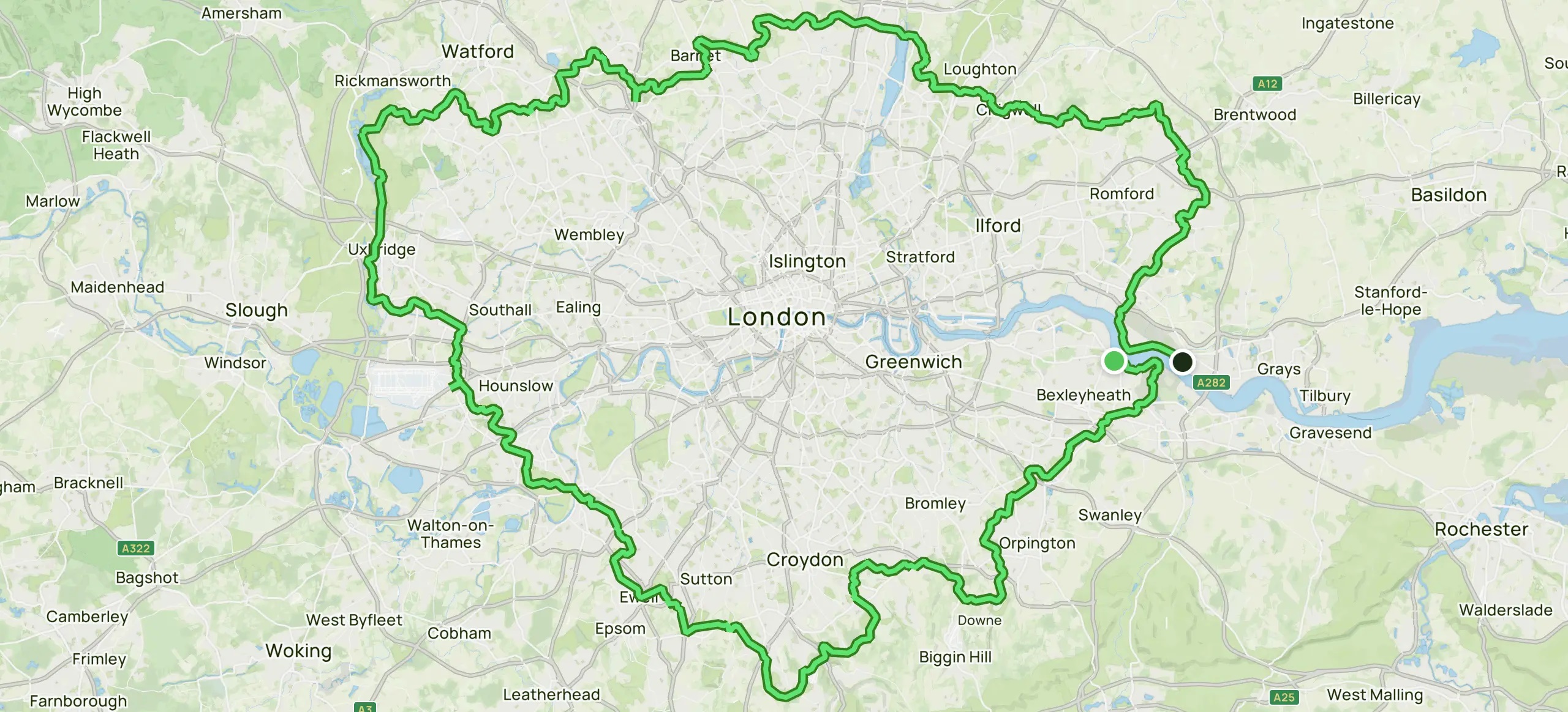
The London Outer Orbital Path, usually called the London LOOP, almost completely encircles Greater London and is divided into 24 shorter walks.
Good visitor option:Uxbridge → Harefield is a manageable section following the Grand Union Canal and giving you a more rural-feeling stretch of Greater London.
Thames Path
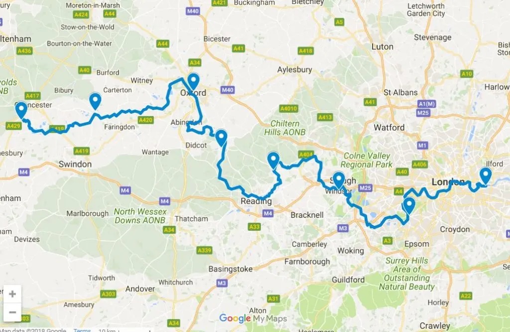
- Best for:river views, bridges and adaptable sightseeing
- Distance:79.5 miles / 128 km
- Approx. walking time:~26.5 hours total
- Typical visitor approach:Selected riverside sections
- Official route information:TfL Thames Path
TfL's current Walk London page describes the Thames Path route across both banks, with sections running through west, central and east London. For visitors, the practical advantage remains its flexibility: you can choose anything from a short riverside stroll to a full-day section.
Useful visitor sections:
- Westminster → Tower Bridge:best for iconic sightseeing.
- Hammersmith → Barnes → Chiswick:best for quieter riverside London.
- Richmond → Ham House:best for views, historic houses and riverside scenery.
- Canary Wharf → Greenwich:best for modern architecture meeting historic London.
Official-route takeaway:these eight routes are best understood as networks of sections, not eight giant walks you must complete from end to end.
The Best Self-Guided London Walks
The official network tells you where London's major trails are. These shorter curated routes answer a different question: What should I actually walk on my visit?
Westminster → South Bank → Tower Bridge
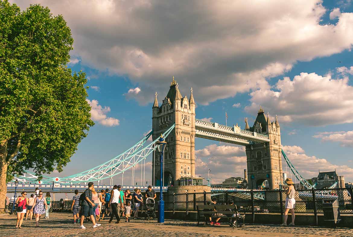
- Best for:first-time visitors and iconic London
- Start:Westminster
- Finish:Tower Bridge or London Bridge if shortened
- Nearest transport:Westminster, Waterloo, London Bridge or Tower Hill depending on where you start/finish
- Distance:~4–4.5 miles / 6.5–7.2 km
- Walking time:~1.5–2 hours
- Allow:3–4 hours with sightseeing, photographs and food stops
Suggested route:Big Ben and Parliament → Westminster Bridge → London Eye → Southbank Centre → Tate Modern → Shakespeare's Globe → Borough Market → Tower Bridge.
This is the strongest first-time option because it combines so many famous London landmarks, riverside walking and several easy exit points. The Thames also makes navigation relatively simple, while bridges and Tube stations give you several opportunities to shorten the walk.
The route works particularly well during the day, but an evening version can provide a different atmosphere around the illuminated river and bridges. You can also use the guide to London's illuminated bridgesto plan a night-time variation.
For a broader guide to London's major bridge views and walking connections, see the guide to London's iconic bridges.
Smart shortcut:Finish at Waterloo, Blackfriars or London Bridge instead of continuing to Tower Bridge.
Why choose it:For a first London visit, this is one of the strongest choices when the priority is seeing a large number of famous sights without constantly changing transport.
Royal London: Westminster → St James's Park → Buckingham Palace → Hyde Park

- Best for:royal landmarks, ceremonial London and green space
- Start:Westminster
- Finish:Hyde ParkCorner or Kensington, depending on the length
- Nearest transport:Westminster, Green Park, Hyde Park Corner or Kensington
- Distance:~3.5–5 miles / 5.6–8 km
- Walking time:~1.5–2.5 hours
- Allow:3–4 hours with sightseeing, photographs and park stops
Route:Westminster → St James's Park → Buckingham Palace → Green Park → Hyde Park → Kensington Gardens.
This route combines several of London's most recognisable royal landmarks with some of its best-known parks. For more ideas beyond this walk, see the guide to the best parks in London.
You can keep it compact around Westminster and Buckingham Palace or extend westwards through Hyde Park and Kensington Gardens. For a formally marked Royal Parks route, the Diana Memorial Walk links the four Royal Parks; check current Royal Parks informationbefore setting out.
Smart shortcut:Finish around Green Park, Hyde Park Corner or Kensington.
Why choose it:Choose this over the Thames route when you want London's royal identity and open green spaces to be the main focus.
South Kensington → Knightsbridge → Piccadilly → Soho
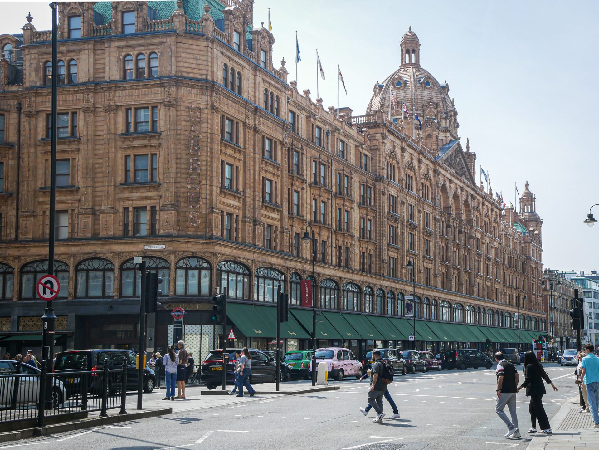
- Best for:museums, luxury shopping, architecture and West End atmosphere
- Start:South Kensington
- Finish:Soho / Piccadilly Circus
- Nearest transport:South Kensington, Knightsbridge, Green Park, Piccadilly Circus or Leicester Square
- Distance:~3.2 miles / 5.1 km
- Walking time:~1.5–2 hours
- Allow:3–5 hours with museums, shopping, photographs and food stops
Route:V&A/Natural History Museum area → Harrods → Knightsbridge → Hyde Park Corner/Wellington Arch → Piccadilly → Leicester Square/Piccadilly Circus → Soho.
It also works as a useful introduction to several very different London neighborhoods, from polished Knightsbridge to lively Soho. For more detail on the museum stops along this route, see the guide to the top museums in London.
The route is particularly effective as a late-afternoon walk, finishing in Soho when restaurants and the West End begin to come alive.
Smart shortcut:Finish around Piccadilly Circus if you want dinner or a theatre nearby.
Why choose it:Pick this when you want museums, architecture, shopping and neighbourhood atmosphere rather than a single line of landmarks.
Little Venice → Camden → King's Cross
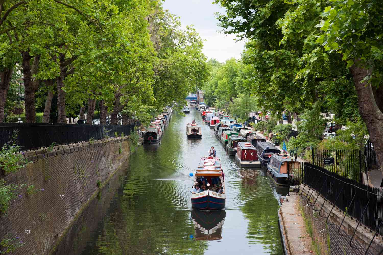
- Best for:canal scenery, narrowboats and relaxed urban walkingStart:Little Venice
- Finish:King's Cross / Granary Square
- Nearest transport:Paddington, Warwick Avenue, Camden Town, Camden Road or King's Cross depending on the section
- Distance:~4–5 miles / 6.5–8 km
- Walking time:~2–2.5 hours
- Allow:3–4 hours with photographs, Camden Market and food stops
Route:Little Venice → Regent's Canal → Camden Lock → canal towpath → King's Cross → Granary Square/Coal Drops Yard.
The route follows Regent's Canal through changing neighbourhoods and waterside scenes. Little Venice provides a calm start, Camden a busier market atmosphere, and King's Cross a modern architectural finish.
The walking is relatively straightforward, but the total outing becomes longer once you explore Camden or stop around King's Cross.
Smart shortcut:Stop around Camden if you want a shorter outing.
Why choose it:Pick this after you've seen the main Westminster and South Bank sights and want a canal-focused route.
Hampstead Village → Hampstead Heath
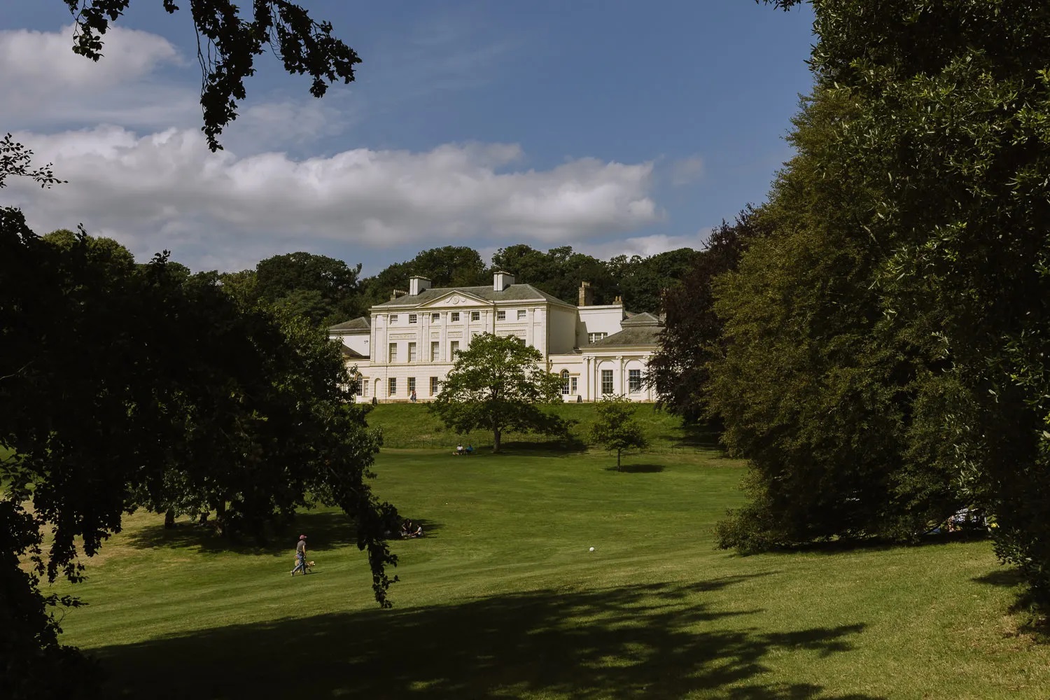
- Best for:nature, panoramic views and village atmosphere
- Start:Hampstead
- Finish:Hampstead or Highgate depending on the chosen loop
- Nearest transport:Hampstead and Golders Green
- Distance:~3–6 miles / 5–10 km depending on the Heath route
- Walking time:~1.5–3 hours
- Allow:3–5 hours with village exploration, viewpoints and stops
Route:Hampstead station → Hampstead Village → Holly Walk/Flask Walk → Hampstead Heath → Parliament Hill → ponds → optional Kenwood → return.
The appeal is the abrupt change from urban streets to open heathland. Parliament Hill provides a major viewpoint, while the village adds a different character before and after the main walk.
Because the Heath contains many paths, treat this as a flexible route rather than a rigid itinerary.
Smart shortcut:Concentrate on Hampstead Village and Parliament Hill.
Walking note:Natural paths can become muddy after wet weather.
Why choose it:Pick this when you want open space and woodland without leaving London.
Blackheath → Greenwich Park → Greenwich
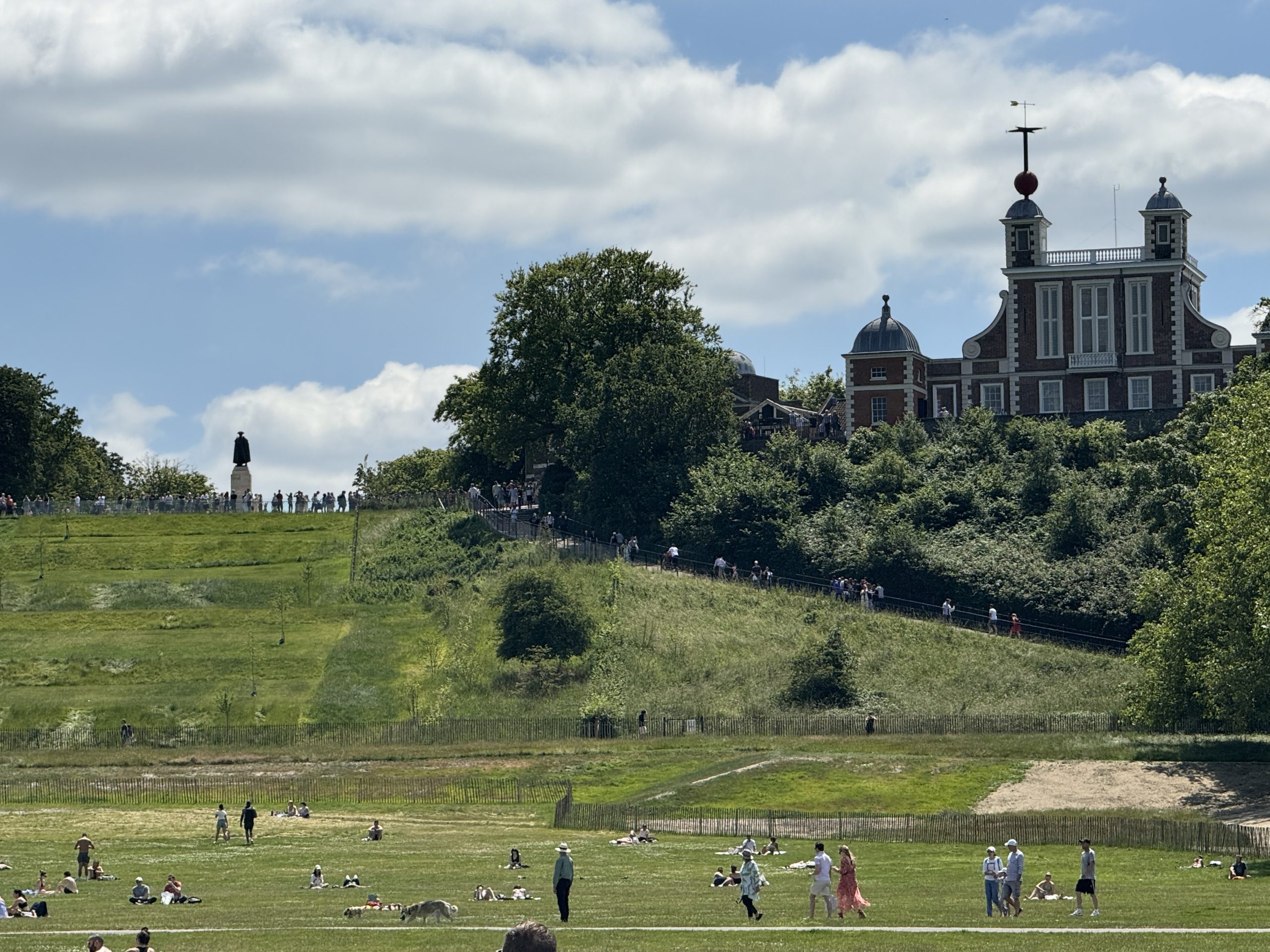
- Best for:views, history and a village-to-river experience
- Start:Blackheath
- Finish:Greenwich
- Nearest transport:Blackheath and Greenwich stations
- Distance:~2–6 miles / 3.2–9.7 km depending on extensions
- Walking time:~1–3 hours
- Allow:3–5 hours with Greenwich sights, photographs and food stops
Route:Blackheath Village → Blackheath → Greenwich Park → Royal Observatory → General Wolfe statue → Greenwich → Cutty Sark/Old Royal Naval College.
The route moves naturally from Blackheath's open landscape to Greenwich Park's viewpoint and then down to the historic riverfront.
For readers who want to understand the historical character behind neighbourhood-based routes, the walking tours of historic London neighborhoodscan provide useful context alongside this walk.
You can keep the walk short by focusing on Greenwich Park, or extend it into a full half-day around the Cutty Sark, Old Royal Naval College and riverside.
Park note:Greenwich Park's pedestrian gates open early but close at dusk, and opening times or temporary closures can vary. Check the current Royal Parks Greenwich Park informationbefore a late walk.
Smart shortcut:Start directly in Greenwich if you do not need the Blackheath section.
Why choose it:Choose this when you want a walk with a clear scenic high point and a historic finish.
Hammersmith → Barnes → Chiswick
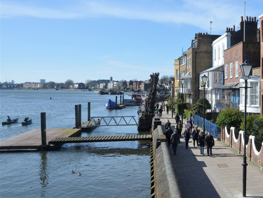
- Best for:a quieter Thames-side experience, riverside scenery and pubs
- Start:Hammersmith Bridge
- Finish:Chiswick
- Nearest transport:Hammersmith and Chiswick rail/Tube connections depending on the endpoint
- Distance:~5–7 miles / 8–11 km
- Walking time:~2–3 hours
- Allow:4–5 hours with riverside stops, food and pub breaks
Route:Hammersmith Bridge → Barnes riverside → Barnes Wetland area → Chiswick → optional extension towards Putney.
This is a very different Thames experience from Westminster and South Bank. The river remains the central feature, but the surroundings become greener and more residential.
It works well as a relaxed afternoon where the walking itself is the attraction.
Smart shortcut:Finish in Barnes or Chiswick rather than extending towards Putney.
Why choose it:Pick this when you've already seen central London and want a quieter riverside experience.
Canary Wharf → Greenwich
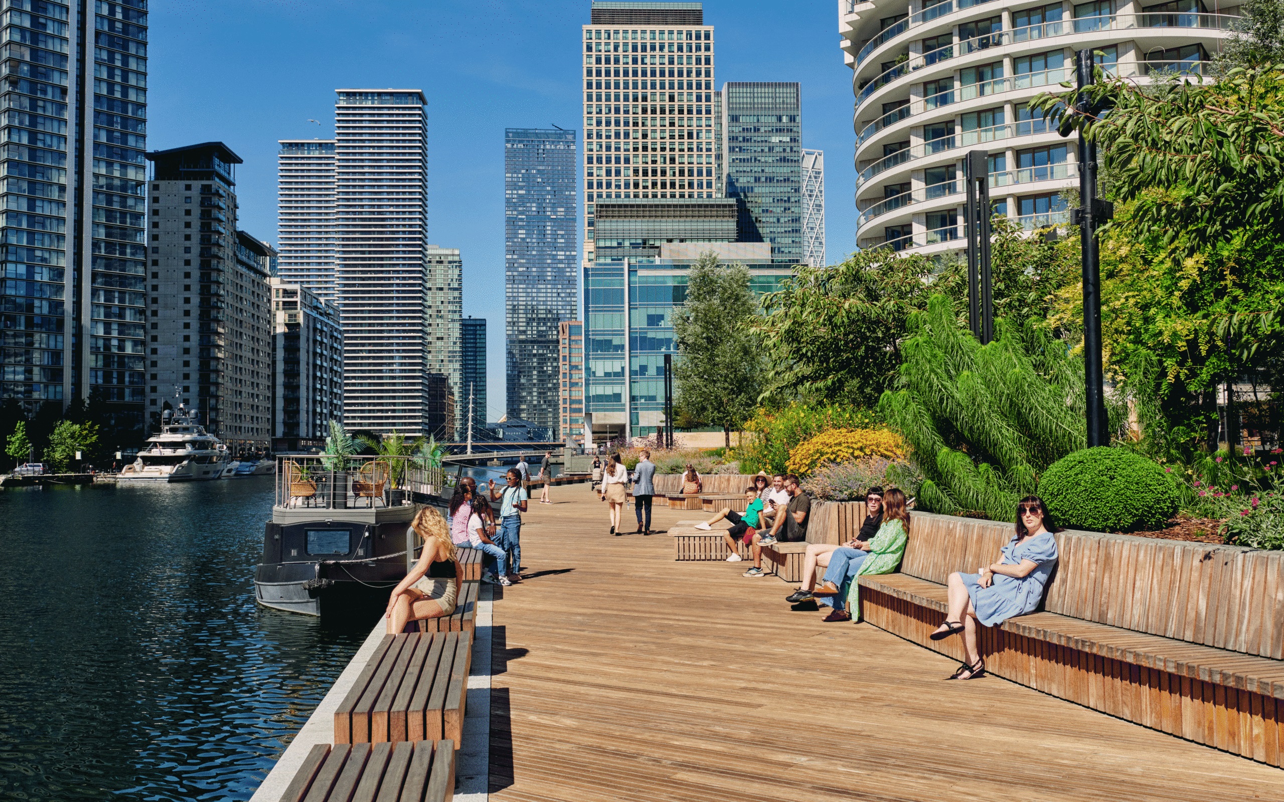
- Best for:modern architecture, waterways and historic London
- Start:Canary Wharf
- Finish:Greenwich
- Nearest transport:Canary Wharf and Greenwich stations
- Distance:~5 miles / 8 km
- Walking time:~2–2.5 hours
- Allow:3–5 hours with photographs, riverside stops and Greenwich sightseeing
Route:Canary Wharf → Isle of Dogs riverside → Thames Path sections → Greenwich Foot Tunnel → Cutty Sark → Old Royal Naval College.
The route contrasts Canary Wharf's contemporary towers with Greenwich's maritime history and historic buildings. The Greenwich Foot Tunnel provides a memorable transition between the two environments.
Smart shortcut:Start directly at Greenwich if the Canary Wharf section is not important to you.
Why choose it:Choose this when the contrast between modern architecture and historic London is a major part of the experience.
Parkland Walk
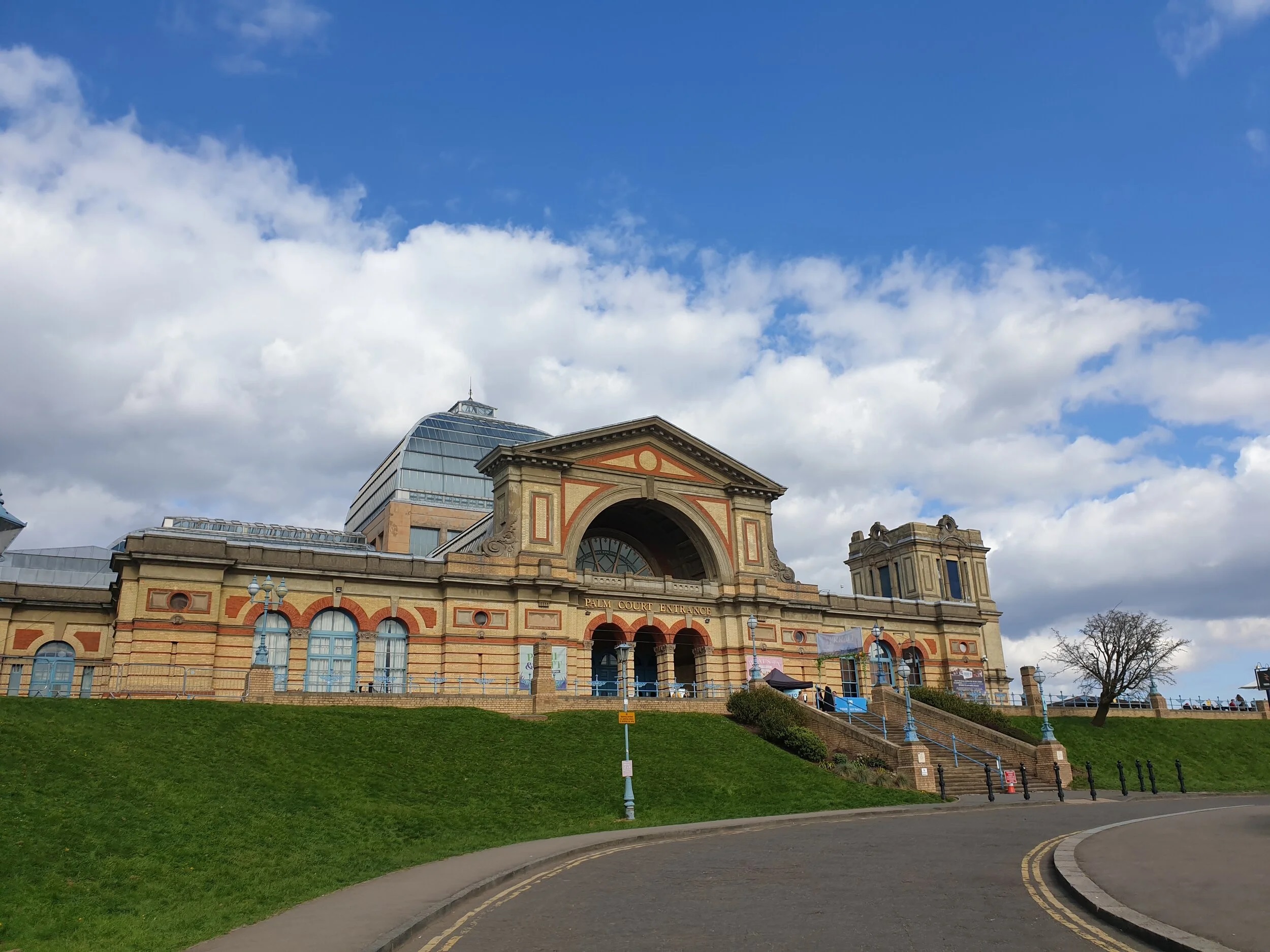
- Best for:urban nature, former railway scenery and a quieter North London route
- Start:Finsbury Park
- Finish:Highgate, unless extending further
- Nearest transport:Finsbury Park and Highgate
- Distance:~1.7 miles / 2.8 km to Highgate; the full Parkland Walk to Alexandra Park is about 2.2 miles / 3.5 km.
- Walking time:~35–45 minutes to Highgate at a steady pace
- Allow:2–3 hours with photographs, nature stops and local detours
Route:Finsbury Park → Parkland Walk → Highgate → optional onward route towards Alexandra Palace.
The route follows a former railway corridor through North London, creating a greener experience within a densely built-up part of the city.
It is especially useful for repeat visitors who have already covered central London's headline sights.
Smart shortcut:Finish in Highgate rather than extending further north.
Why choose it:Pick this when you want a local-feeling green route without committing to a long-distance walk.
St Paul's And The City
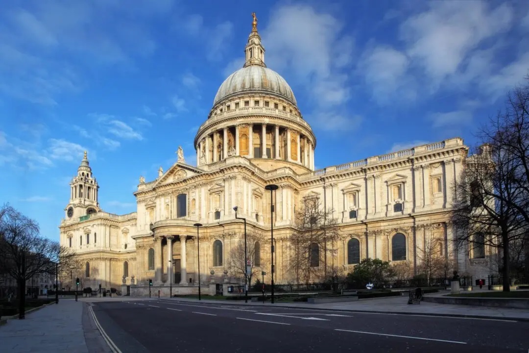
- Best for:architecture, historic streets and old-meets-new London
- Start:St Paul's
- Finish:City / Leadenhall area
- Nearest transport:St Paul's, Bank or Mansion House depending on the route
- Distance:~2 miles / 3.2 km
- Walking time:~1–1.5 hours
- Allow:2–3 hours with photography, church visits and architecture stops
Route:St Paul's Cathedral → Wren churches → City streets → Leadenhall area → Gherkin → Walkie Talkie/Sky Garden area.
This route is less about distance than about seeing London's architectural layers in a short space. Historic churches and streets sit alongside recognisable modern skyscrapers.
Smart shortcut:The core route already works as a short walk; extend only when a particular building or viewpoint interests you.
Why choose it:Pick this when you have limited time but want strong architectural variety.
Battersea Park
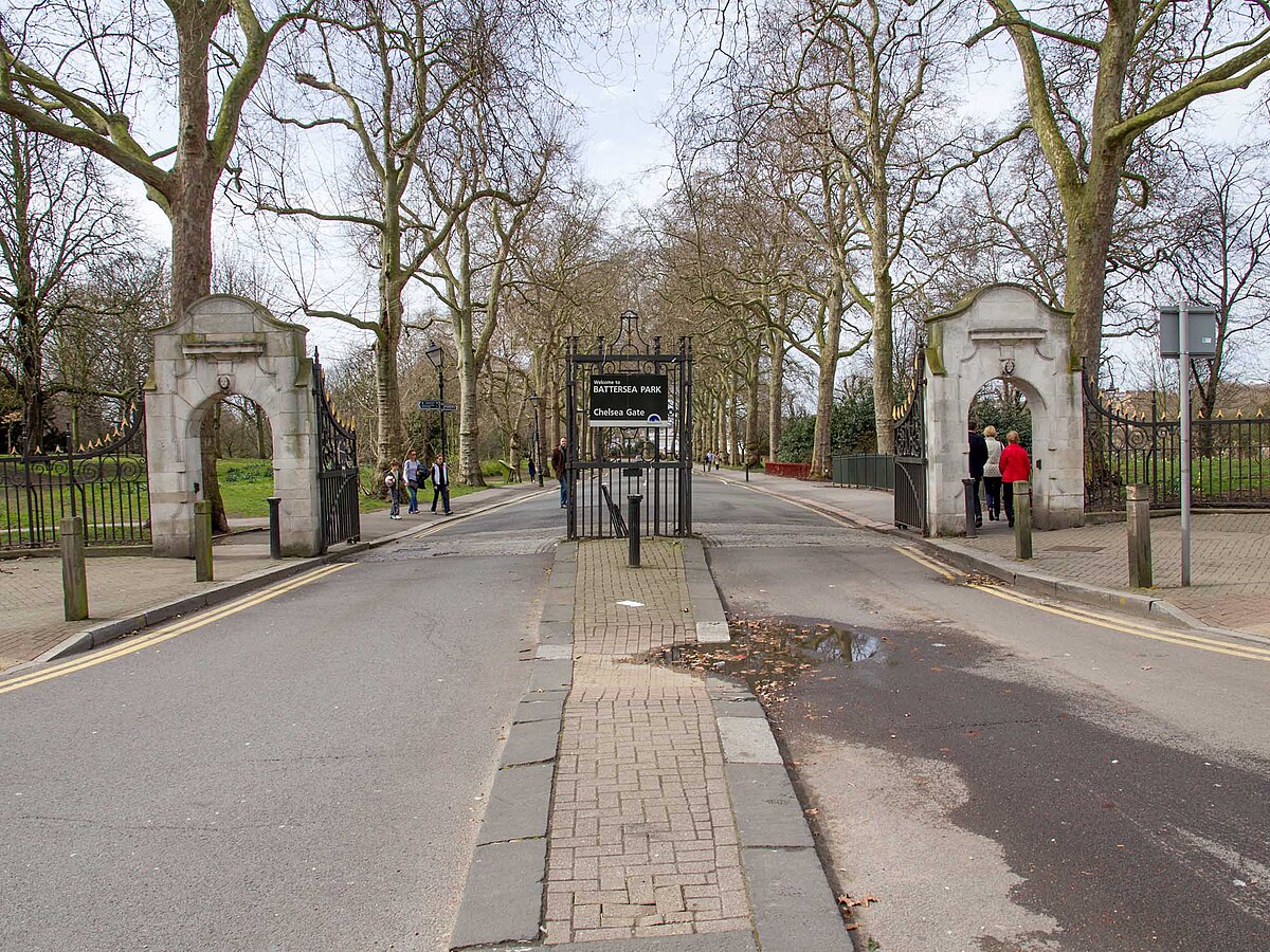
- Best for:families, green space and contemporary riverside London
- Start:Chelsea Gate / Battersea Park
- Finish:Battersea Park or Battersea Power Station if extended
- Nearest transport:Battersea Power Station and rail/Tube connections around the park
- Distance:~2.2 miles / 3.5 km around the park
- Walking time:~45–60 minutes
- Allow:2–3 hours with gardens, lake, play areas, cafés and an optional Battersea Power Station extension
Route:Chelsea Gate → park perimeter → Old English Garden → boating lake → optional extension towards Battersea Power Station.
This is a useful short alternative when a full central sightseeing walk feels too demanding. The park provides room to slow down, while Battersea Power Station gives you an optional contemporary finish with food and riverside space.
Smart shortcut:Keep to the park loop for a simple under-one-hour walk.
Why choose it:Choose this when you want a flexible green-space break, particularly with children.
The Line
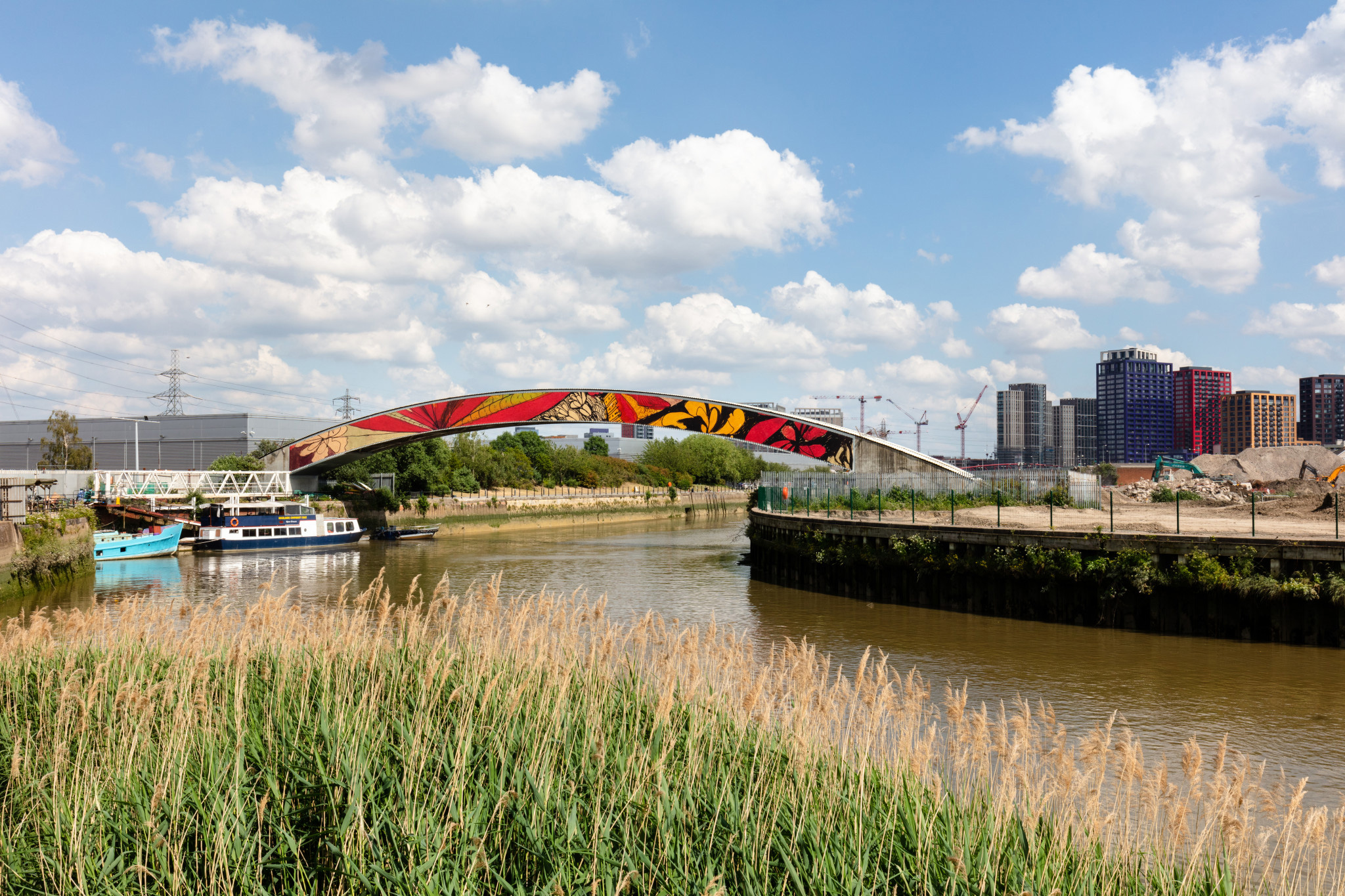
- Best for:public art, waterways and East London
- Route status:Current route conditions and diversions should be checked before setting out.
- Approximate walking time:About 4 hours, depending on how long you spend with artworks and at cafés.
The Line is different from a conventional sightseeing walk because the route itself is an outdoor cultural experience. It combines public art with waterways and several areas of East London that rarely appear in traditional first-time London itineraries.
Important current note:The Line currently has a temporary diversion near Queen Elizabeth Olympic Park because of building works. The full experience also involves transport connections between some sections, including the IFS Cloud Cable Car and a short DLR journey. Check the official visitor information and mapbefore setting out.
Why choose it:Pick The Line when public art and contemporary East London matter more to you than a conventional landmark route.
Epping Forest Big Walk
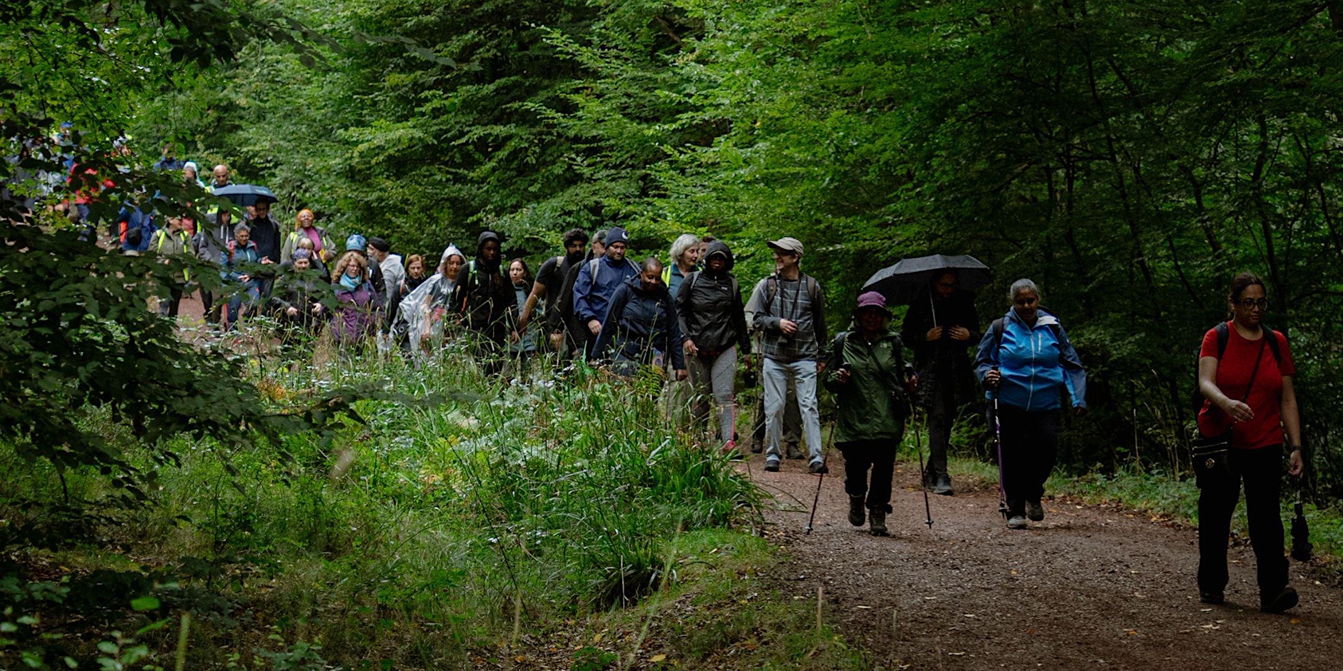
- Best for:full-day woodland walking and a break from central London
- Start:Manor Park, Newham
- Finish:Epping / Bell Common
- Distance:14.1 miles / 22.7 km
- Walking time:roughly a full day for a continuous walk; allow longer for breaks
The Epping Forest Big Walk, formerly known as the Epping Forest Centenary Walk, runs from Manor Park in East London to Epping in Essex. Epping Forest Heritage Trustcurrently gives the route as 14.1 miles / 22.7 km and notes that it can also be broken into shorter sections accessible by public transport.
The route crosses Wanstead Flats, Highams Park and other parts of the Forest before finishing towards Epping. It is a better fit for walkers who actively want a long woodland day than for visitors trying to maximise central London landmarks.
Smart shortcut:Use the Trust's current map to choose a shorter public-transport-accessible section rather than attempting the full route.
Why choose it:Choose this when the point of the day is woodland and a substantial walk rather than sightseeing in central London.
London Walking Routes By Time
Use time as the first filter, then choose the route that matches your interests above.
| Time available | What to choose |
| 60–90 minutes | Westminster and the Thames, St Paul's and the City, Greenwich Park or Battersea Park |
| 2–3 hours | Westminster → South Bank, South Kensington → Soho, Little Venice → Camden, Greenwich or Hampstead Heath |
| Half a day | Westminster → Tower Bridge, Blackheath → Greenwich, Hammersmith → Barnes → Chiswick, Canary Wharf → Greenwich or Hampstead Village → Hampstead Heath |
| Full day | A section of the Capital Ring, Green Chain, Green Link Walk, Jubilee Greenway, Lea Valley, LOOP or Thames Path; or the Epping Forest Big Walk |
Time rule:add sightseeing time to walking time. A route described as a two-hour walk can easily become a half-day outing once you include museums, markets, photographs and food.
London Walking Routes Map: How To Navigate Your Walk
You do not need ten different navigation tools. You need the right tool for the job. A London mapis useful for understanding how your walking route relates to neighbourhoods, landmarks, the river and transport.
Use A Walking App For Detailed Navigation
Use a reliable walking-navigation app for the street-by-street part of the journey, particularly for self-guided routes that are not official waymarked trails.
Before leaving, save:
- your start point
- major route landmarks
- your intended finish
- one or two transport exits
- your food stop
- the official route map for any named long-distance trail you are following
Use TfL Go For Transport Connections
TfL Goprovides live transport information and journey planning, making it useful when your walk finishes somewhere different from where it starts. TfL also provides accessibility options through its journey-planning tools.
Use Official Route Maps For Long-Distance Walks
For the Walk London Network, start with the official TfL route maps and written directions. TfL also supports step-by-step route information through Go Jauntly.
For routes such as The Line and the Epping Forest Big Walk, use the current map supplied by the organisation responsible for the trail.
Download Or Save Maps Before Leaving Wi-Fi
Where your chosen navigation tool supports offline mapping, save the relevant area before leaving. Also keep the official route map available for established long-distance trails.
TfL's walking resources also include Legible London wayfinding, which uses maps and signs to help people navigate shorter journeys on foot.
Navigation rule:use a walking-navigation app for detailed directions, TfL for live transport and accessibility information, and the official route map for established long-distance trails.
How To Plan A Self-Guided London Walk
The best self-guided walk is planned around flexibility, not just distance.
Check The Route Before Leaving
Check the start and finish, walking time, major crossings, transport nearby, places to stop, attraction opening constraints and any current route notices, diversions or closures.
Choose Your Start Point Around Transport
A route is much easier when you can reach its starting point directly. If you need help choosing between walking, the Tube, buses, DLR or rail for the journey to and from the route, see the guide on how to get around London.
For routes where a bus is the easiest connection, travellers can also preview the road-level experience through London bus ride streamsbefore deciding how they want to reach the start of their walk.
This matters especially on the Capital Ring, Green Chain, Green Link Walk, Lea Valley and London LOOP, where the route itself is far larger than most visitors' walking day.
Know Where You Can Shorten The Route
Before starting, identify at least one Tube station, railway station, bus corridor, river crossing or other logical exit. That gives you a practical way to shorten the walk if the weather, energy or schedule changes.
Check Access And Surface Conditions
Not every route has the same surfaces or accessibility profile. For transport, TfL provides step-free journey-planning information. For the walking route itself, check the official information where accessibility, terrain or current path conditions matter to your plans.
For example, Hampstead Heath has natural paths that can become muddy after wet weather, while Greenwich Park opening times and temporary closure information should be checked before a late walk.
Frequently Asked Questions
What Are The Best Walking Routes In London?
The best route depends on your priority. Choose Westminster and the Thames for famous landmarks, Hampstead for greenery and views, Regent's Canal for waterside walking, and the Capital Ring or LOOP for longer walks.
What Is The Best Self-Guided London Walk?
For first-time visitors, Westminster → South Bank → Tower Bridge is one of the strongest options because it combines major landmarks, riverside walking and several easy points where you can shorten the route.
What Is The Best Walking App In London?
A walking-navigation app such as Google Maps is useful for detailed walking directions, while TfL Go is better for official public transport information and journey planning. Citymapper can also be useful when you need to combine walking with Tube, bus or rail journeys.
How Long Do London Walking Routes Take?
London walking routescan take anywhere from under an hour to several hours. For sightseeing, allow extra time for photographs, attractions, crossings and food stops; long-distance trails such as the Capital Ring and LOOP are best walked in sections.
Which London Walks Are Family-Friendly?
Choose routes with open space, food stops, easy transport access and simple ways to shorten the walk. South Bank, Greenwich and Battersea Park are particularly flexible choices.
Are London Walking Routes Free?
Most self-guided London walking routes are free to walk. Your main costs are usually transport, food and any attractions you decide to enter.
What Should I Check Before Starting A Self-Guided London Walk?
Check the current route map, your start and finish points, transport connections, park opening times and any temporary diversions or closures. This is especially important for routes affected by construction or changing access conditions.
What Are The Eight Official Walk London Routes?
They are the Capital Ring, Green Chain, Green Link Walk, Jubilee Greenway, Jubilee Walkway, Lea Valley Walk, London LOOP and Thames Path. TfL provides maps and directions for the network, with the routes designed to be walked in sections and accessed by public transport.
Conclusion
London is particularly rewarding to explore on foot because you can choose a route that matches the time and experience you want rather than treating the city as one giant sightseeing circuit.
Start with a compact route such as Westminster and the Thames, Little Venice to Camden, Greenwich or Battersea Park when time is limited. When you want a longer or greener day, use a section of the Capital Ring, Green Chain, Green Link Walk, Lea Valley, LOOP or Thames Path. For a dedicated woodland day, the Epping Forest Big Walk provides a much longer alternative outside central London.
The most useful approach is simple: choose the route by time, interest and flexibility, then check the current official map before you leave.
Jump to
Quick Answer: Which London Walk Should You Choose?
How To Choose A London Walking Route That Fits Your Day
The 8 Official Walk London Routes
The Best Self-Guided London Walks
London Walking Routes By Time
London Walking Routes Map: How To Navigate Your Walk
How To Plan A Self-Guided London Walk
Frequently Asked Questions
Conclusion

James Rowley
Author
James Rowley is a London-based writer and researcher covering London life, cultural geography, London travel, live London webcam pages and selected public figures across entertainment, sport, business and public life.
For over 15 years, he has focused on verified sources, first-hand local context and clear explanations that help readers understand both places and people more deeply. His work combines street-level London knowledge with careful research into career credits, media work, business interests and, where relevant, transparently explained net worth estimates.
He writes and reviews articles published on LondonWebcam.
Latest Articles
Popular Articles