London Borough Name Meanings - History Behind The Map
London Borough Name Meanings are easier once the map makes sense. Learn the 32 boroughs, the City of London, and the story behind the names.
Author:James RowleyApr 13, 20269.3K Shares172.6K Views
London Borough Name Meanings: A Clear Guide To The History Behind The Map
Westminster sounds ecclesiastical, Camden sounds personal, Brent feels older than the city around it, and Newham looks almost suspiciously modern.
They are modern administrative labels for 32 borough councils, but many of them also preserve much older clues about rivers, churches, estates, woodland clearings, and the people who once held land there.
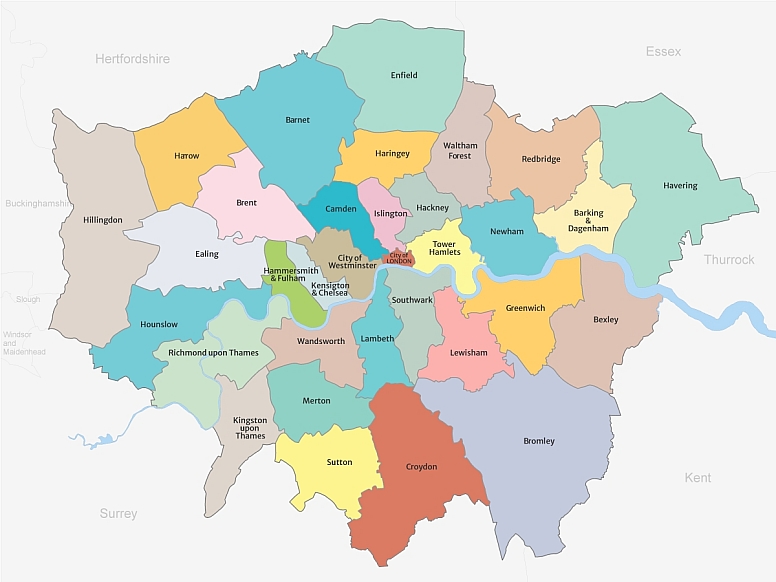
Officially, Greater London is made up of 32 London boroughs plus the separate City of London, and the current borough structure dates from the reorganisation that took effect on 1 April 1965.
What follows is built to solve both parts of the puzzle: what the borough system is, and what the names actually mean.
The aim is not just to decode labels, but to make London’s map feel more legible once you know what you are looking at.
If you are looking at a London borough map while reading, that will help. This topic makes much more sense once you can see how the names sit across the city rather than reading them as a disconnected list.
Key Takeaways
- London has 32 boroughs, plus the City of London, which is separate.
- The present borough system took effect in 1965 under the London Government Act 1963.
- Many borough names come from Old English or Anglo-Saxon roots, while others come from rivers, churches, people, or modern administrative choices.
- A borough is an official local government area, not the same thing as a district, neighbourhood, or town.
- Once you see the naming patterns, borough names stop looking random and start reading like a compressed history of London.
What A London Borough Actually Is
The fastest way to make sense of borough name meanings is to separate government geography from everyday place names. Once that is clear, the names become much easier to read.
A London borough is one of the capital’s official local authority areas. GOV.UK lists 32 London boroughs, while City Hall explains that London has 33 local government authoritiesonce the City of London Corporation is counted separately.
It is also worth knowing that some boroughs use fuller ceremonial forms, such as Royal Borough of Greenwich, Royal Borough of Kensington and Chelsea, and Royal Borough of Kingston upon Thames, while Westminster is officially the City of Westminster.
Most readers still refer to them in shortened form, but the official versions appear often on council and map materials.
Why Borough Does Not Mean The Same Thing As Neighbourhood
A neighbourhood is how people describe an area they recognise socially or culturally. A borough is a legal and administrative unit with a council, elections, and defined responsibilities.
That is why someone can say they live in Shoreditch, Notting Hill, or Wimbledon in everyday speech, while their official borough is Hackney, Kensington and Chelsea, or Merton. The neighbourhood is lived geography; the borough is governing geography.
Boroughs, Districts, Towns, And Postcodes: The Quick Distinction
This is the confusion that trips up most readers and most travellers. London uses several map systems at once, and they overlap without matching perfectly.
| Term | What it means |
| Borough | An official local authority area with a council, such as Lambeth or Brent. |
| District / area | A common place label that may be historic, planning-related, or simply widely used. |
| Town | A historic settlement name that may sit inside a borough, such as Croydon or Harrow. |
| Neighbourhood | A local identity used socially and culturally, often smaller and less formally bounded. |
| Postcode | A mail-routing system, not a clean map of local government or identity. |
The practical rule is simple:boroughs are official; districts, towns, and neighbourhoods are descriptive. That single distinction removes a great deal of London-map confusion.
Why The City Of London Is Separate From The 32 Boroughs
The City of London is the historic Square Mile, the ancient core from which the rest of London developed.
It has its own corporation, its own historic governance, and a status that functions differently from a London borough.
So when people ask whether London has 32 or 33 boroughs, the clean answer is: 32 boroughs, plus the separate City of London. That distinction matters because many casual explainers blur it.
The key takeaway is that a borough is an official council area, which sets up the next question naturally: why London needed this system in the first place.
Why London Is Split Into Boroughs
Before the names can make historical sense, the structure has to make civic sense.
London is divided into boroughs because a city this large needs local authorities that can handle local services while still fitting into a wider citywide system.
The London Government Act 1963created the new administrative areas known as London boroughs, and the current system took effect on 1 April 1965.
That reorganisation replaced earlier arrangements with the larger Greater London structure that still frames the capital today.
The 1963 Act And The 1965 Reorganisation
This is the modern starting point. The law created the borough framework, but many of the names chosen for those new authorities were older place names rather than fresh inventions.
That matters for interpretation. A borough may be modern as an administrative unit, while its name may be medieval, Anglo-Saxon, Celtic, royal, or ecclesiastical.
In other words, the map was redrawn in 1965, but many of the words on it were much older.
The borough map did not arrive as a tidy, inevitable set of names. In some cases, officials and local leaders debated what the new authorities should be called, and not every final choice was obvious from the start.
That matters because it reminds the reader that borough names are not just ancient leftovers.
Some reflect long local history, while others reflect modern decisions about identity, prestige, geography, or which older place-name should represent a newly grouped area.
What Borough Councils Do Today
City Hall explains the split neatly:the Mayor and the Greater London Authority provide citywide leadership and strategies, while London’s local authorities handle many everyday local services.
City Hall lists local-authority responsibilities such as council housing, rubbish collection, parking, schools, council tax collection, leisure, and social care and public health.
That is why borough names appear constantly in practical life. They are not just historical labels on an old map; they are the names on council websites, planning notices, and local service boundaries.
Inner London Vs Outer London: What Those Labels Really Mean
The London Plan 2021 classifies boroughs as Inner or Outer London. This is an official planning and statistical distinction, not a ranking of prestige or authenticity.
A traveller looking at the map may assume inner and outer are vague descriptions, but in policy terms they are formal groupings.
For example, Camden, Lambeth, Southwark, Tower Hamlets, and Westminster are classed as Inner London, while Barnet, Bromley, Croydon, Redbridge, and Sutton are classed as Outer London.
The takeaway here is that boroughs exist for governance, but their names often predate that system by centuries, which is where the etymology becomes useful rather than ornamental.
How To Read London Borough Name Meanings
This section matters because most borough-name articles make the reader memorise a list.
A more useful approach is to recognise the patterns first, then slot individual boroughs into them.
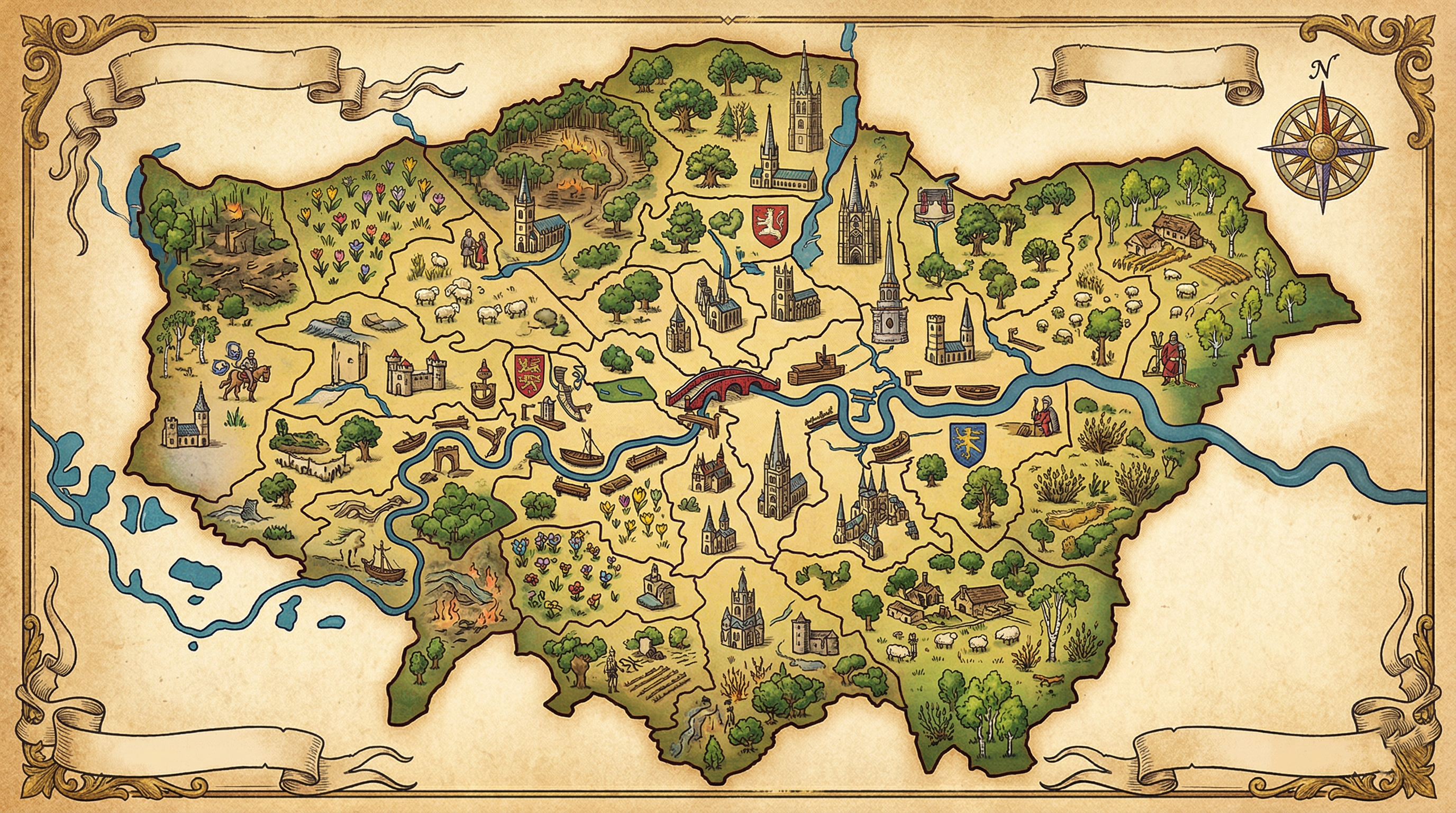
Look at London’s borough names the way a place-name historian would: not as a random alphabet, but as repeating clues about landscape, river access, religion, landowners, and modern political compromise.
One quick note before getting into the examples:borough-name etymology is not always exact or fully settled.
Some meanings are widely accepted, while others are best read as the most commonly repeated explanation rather than a final certainty.
The Five Big Naming Patterns To Look For
- River and waterside names tied to rivers, landing places, bays, or crossings.
- Woodland and farming names clearings, fields, farms, and estates.
- Personal names and titles chieftains, landowners, nobles, or kings.
- Church and abbey names minsters, shrines, and religious sites.
- Modern composite names 1965 borough names that joined older areas under one administrative banner.
A traveller studying a borough map near the Thames might notice Lambeth, Greenwich, Chelsea, and Southwark all carry traces of movement by water.
Another scanning outer boroughs might see how often land, woods, or estates sit behind the names. That is the pattern-reading habit worth building.
How To Read A Borough Name Quickly
When I look at a London borough name, I usually ask four simple questions first:
- Does it sound like a river, crossing, or landing place?
- Does it point to fields, woods, or older settlement land?
- Does it sound tied to a person, family, title, or ruler?
- Does it feel like a later administrative label rather than an ancient place-name?
That quick filter will not solve every name perfectly, but it makes the whole map much easier to understand.
Why So Many Names Sound Anglo-Saxon
Many borough names are rooted in Old English or Anglo-Saxon settlement patterns.
That is why recurring endings and elements feel familiar once you spot them: forms linked to homesteads, fields, clearings, estates, enclosures, hills, and landing places show up again and again across Greater London.
This is also why names can feel rough-edged or unusual in modern spelling. The current form is often the end result of many centuries of sound change, clerical spelling, and local usage rather than a neat one-to-one translation.
Why Some Names Feel Ancient While Others Feel Administrative
Some borough names really are ancient. Brent is commonly traced to a Celtic river name that predates the Anglo-Saxons, while Southwark reaches back to very early defensive and settlement language.
Others, such as Newham and Redbridge, feel more modern because they were shaped or selected in relation to the 1965 borough map.
That mix is what makes London so readable once the pattern clicks: one map, but several historical layers speaking at once. The next section puts those layers into examples you can remember.
London Borough Name Meanings By Pattern, Not Just By Alphabet
The real value here is memory. Grouping boroughs by naming logic makes them easier to understand than an A-to-Z list ever will.
The examples below are the boroughs that best demonstrate the big naming families.
They also show why the same city can contain Celtic river names, medieval church references, aristocratic surnames, and obvious modern composites side by side.
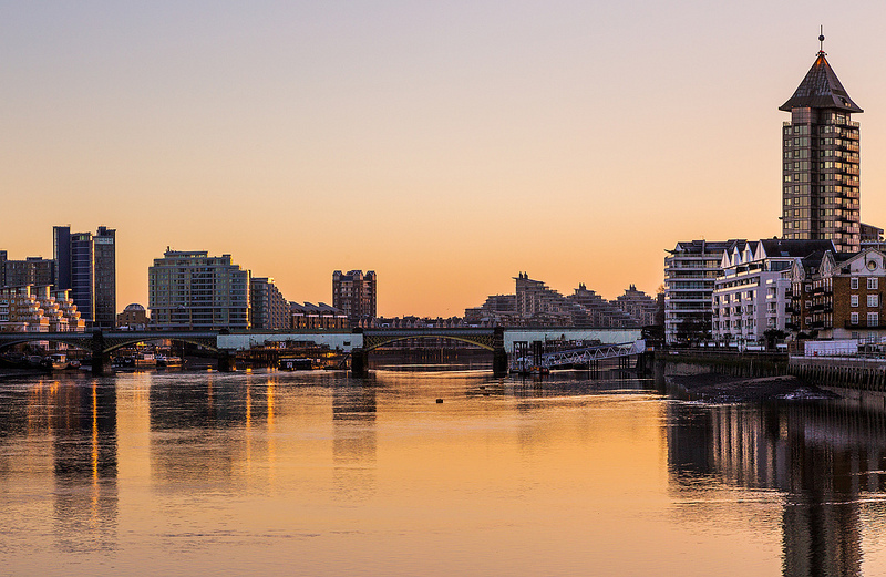
River And Landscape Names
Water explains more London names than many visitors realise. The Thames, its crossings, and smaller rivers repeatedly shaped how places were named and remembered.
Brent
Brent is commonly explained as an ancient Celtic river name, often glossed as holy one or high place. It stands out because it appears older than many of the Anglo-Saxon-derived borough names around it.
Greenwich
Greenwich is commonly traced to Grenewic, often rendered as a green port or green place by the bay. Either way, it is a useful example of a borough name tied to waterside settlement.
Richmond Upon Thames
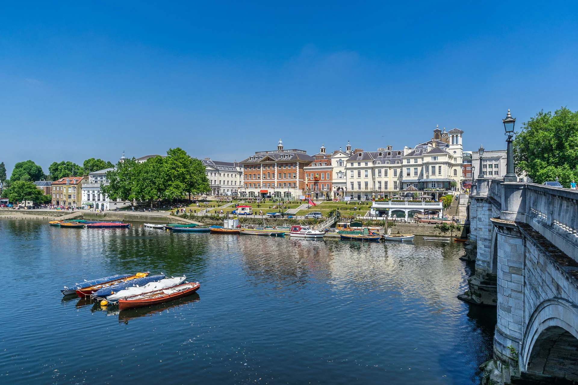
Richmond is comparatively late by London standards. The borough name connects to Richmond Palace and Henry VII’s title as Earl of Richmond, with the underlying place-name pointing back to an Old French sense of a strong hill.
Redbridge
Redbridge is one of the most transparent modern borough names. It refers to a red bridge over the River Roding, which makes it a good reminder that not every London borough name is ancient or obscure.
Woodland, Farming, And Settlement Names
This is the pattern that makes old London feel surprisingly rural. Before the modern capital spread across the landscape, much of this area was read through woods, clearings, fields, and farmsteads.
Barnet
Barnet is commonly explained from bærnet, meaning land cleared by burning. It is one of the clearest examples of a landscape transformed into a place-name.
Bexley
Bexley is commonly glossed as pasture by the stream, often linked to the River Cray. It fits the pattern of an older settlement named for useful land beside water.
Bromley
Bromley is generally explained as a woodland clearing where broom grows. It belongs squarely in the vegetation plus clearing family of English place names.
Croydon
Croydon is one of the most memorable borough meanings because it is commonly explained as the valley of the crocuses.
It sounds poetic today, but it also reminds the reader that older landscapes were often named for plants, cultivation, or visible natural features.
Enfield
Enfield is usually given with two possibilities: a field linked to a person named Eana, or a place connected with lambs.
It is a good example of how place-name history can preserve uncertainty rather than offering one final answer.
Havering
Havering is commonly linked to the followers of a man called something like Haefer. It reads like a personal-name origin, but it still belongs to the older settlement pattern rather than a modern coinage.
Sutton
Sutton is usually explained simply as south farm. The plainness of the meaning is part of its value: many English place names were functional before they were romantic.
Boroughs Named After People, Families, Or Titles
This is the pattern that makes some borough names feel less geological and more social. These names preserve ownership, authority, or association with named figures.
Camden
Camden comes from Charles Pratt, 1st Earl of Camden, which is why it feels different from older landscape-based names.
It is a borough name rooted in title and landholding rather than a stream or field.
Haringey
Haringey is commonly traced to Haeringes-hege, the enclosure of a Saxon chief called Haering. That makes it a good bridge between personal-name origins and older rural boundaries.
Merton
Merton is usually explained either as farm by the pool or Maera’s homestead. It is another useful case where the historical record leaves room for more than one plausible reading.
Richmond
Richmond belongs here as well because its borough identity is tied to royal and noble naming history rather than only to landscape.
Henry VII’s former title helped carry the name into London through the palace.
Church, Abbey, And Religious-rooted Names
Not every borough name begins with a field or a person. Some encode sacred sites and religious geography so directly that the clue is still audible once you know what to listen for.
Westminster
Westminster refers to the western minster, distinguishing the abbey church from an eastern church. It is one of the cleanest examples of ecclesiastical naming surviving at the heart of modern London.
Lambeth
Lambeth comes from Old English lambhythe, commonly rendered as the place or landing place where lambs landed. It is a small masterpiece of mixed practical and pastoral naming.
Modern And Composite Borough Names Shaped By The 1965 Map
Not every present-day borough name arrived in its final form at exactly the same moment, but this group shows how modern London’s map brought older place-names together into newer administrative identities.
Some borough names look exactly like what they are: compromises, combinations, or later labels chosen to serve an administrative map.
Barking And Dagenham
This paired borough name openly preserves two older places. Barking is usually linked either to a person called Bereca or to birch trees, while Dagenham carries the sense of the homestead of Dæcca.
Hammersmith And Fulham
This is another composite case. Hammersmith has disputed origins, while Fulham is commonly linked to an Anglo-Saxon figure called Fulla and a bend in the river.
Kensington And Chelsea
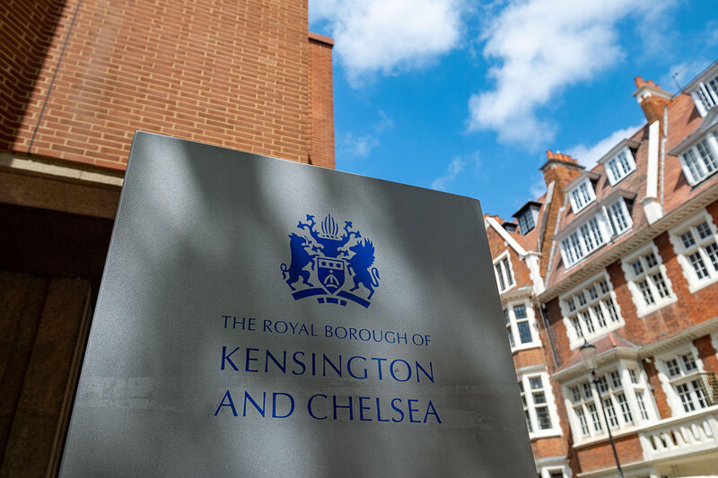
Kensington is commonly tied to a person named Cynesige or Kenesigne, while Chelsea is often explained as a landing place or wharf for chalk. Together they show how one borough can carry two quite different naming histories.
Newham
Newham is one of the clearest modern borough names. It was formed in 1965 from East Ham and West Ham, with new signalling the new administrative unit.
Waltham Forest
Waltham Forest uses an old regional name associated with what is now Epping Forest. It demonstrates how the 1965 map sometimes reached back into older territorial language rather than just merging nearby towns mechanically.
The takeaway is that borough names work best when you read them by family resemblance: river names, field names, titled names, church names, and 1965 composites. That makes the full reference table much easier to use.
The Full Quick-reference Table Of All 32 London Borough Name Meanings
This section is designed for scanning. The meanings below are plain-English, simplified readings of the borough names rather than final, uncontested scholarly verdicts.
Where place-name history is uncertain, the wording stays cautious on purpose. London place-name references often preserve multiple plausible readings, especially for the oldest names.
How To Use This Table Without Getting Stuck On Disputed Origins
Read the table as a working translation, not a legal definition. The goal is to help the reader recognise the logic behind the name, not to pretend every medieval spelling question has one final answer.
A Note On Commonly Explained As Vs Certain Etymology
For boroughs like Croydon, Brent, or Westminster, the headline explanation is widely repeated and useful. For others such as Enfield, Hounslow, or Hammersmith, it is more honest to say commonly explained as or possibly from.
| Borough | Commonly explained meaning |
| Barking and Dagenham | Birch-tree settlement or Bereca’s people + Dæcca’s homestead |
| Barnet | Land cleared by burning |
| Bexley | Pasture by the stream |
| Brent | Ancient river name, often glossed as holy one or high place |
| Bromley | Woodland clearing where broom grows |
| Camden | Named after the Earl of Camden |
| Croydon | Valley of the crocuses |
| Ealing | The followers of Gilla/Gillas |
| Enfield | Eana’s field, or a place linked with lambs |
| Greenwich | Green port / green place by the bay |
| Hackney | Often linked to Haca’s island or raised ground in marsh |
| Hammersmith and Fulham | Possibly Hammoder’s hythe or hammer-smith area + Fulla’s river bend |
| Haringey | Haering’s enclosure |
| Harrow | Heathen shrine / temple hill |
| Havering | The followers of Haefer |
| Hillingdon | Hill of Hille/Hilda, or hill settlement |
| Hounslow | Possibly hunting land or Hund’s hill |
| Islington | Gisla’s hill |
| Kensington and Chelsea | Cynesige’s settlement + chalk wharf / landing place |
| Kingston upon Thames | King’s estate or manor |
| Lambeth | Landing place for lambs |
| Lewisham | Leofsa’s or Leof’s dwelling |
| Merton | Farm by the pool, or Maera’s homestead |
| Newham | New borough formed from East Ham and West Ham |
| Redbridge | The red bridge over the Roding |
| Richmond upon Thames | Name from Richmond Palace and the Earl of Richmond |
| Southwark | Defensive works of the men of the south |
| Sutton | South farm |
| Tower Hamlets | Hamlets nearest the Tower of London |
| Waltham Forest | Forest estate |
| Wandsworth | Enclosure or estate linked to the River Wandle / Waendel |
| Westminster | Western minster / western church |
These simplified meanings are synthesised from standard London place-name references and the leading borough-etymology summaries, with caution preserved where origins are disputed or multiply reported.
What These Names Reveal About London’s Past
The list matters less than the pattern behind it. Once the borough names are read together, they reveal what sort of landscape London used to be and what kinds of power shaped it.
Instead of a seamless metropolis, the names point to crossings, shrines, woods, grazing land, royal estates, and joined-up settlements.
That is the historical gain most competitor pages leave underexplained.
Rivers Mattered More Than Modern Travellers Assume
A visitor moving across London today may think first in Tube lines and postcodes. The older naming layer thinks first in rivers, landing places, marshy rises, and bays.
That is why names such as Brent, Greenwich, Lambeth, Chelsea, Southwark, and Wandsworth still feel tied to movement, mooring, or crossing. The river was not scenery; it was infrastructure.
Forest Clearings, Farms, And Landing Places Shaped Settlement
Many borough names sound almost agricultural because the early landscape was agricultural.
Barnet, Bromley, Sutton, and parts of Enfield and Merton preserve a world of woodland clearance, pasture, and working land rather than dense urban fabric.
An illustrative traveller staying in modern Barnet might think of commuter routes and suburban high streets.
The name itself points back to a much older act:clearing woodland by fire to make settlement possible.
Power, Religion, And Aristocracy Still Sit Inside The Map
Some borough names are social documents as much as landscape records. Westminster encodes sacred prestige, Kingston royal association, Camden titled ownership, and Richmond dynastic naming.
That is one reason central London names often feel weightier than they first appear. They are carrying institutional memory as much as location.
1965 Did Not Erase Older Identities; It Rearranged Them
The borough system is modern, but it did not wipe the older place-name layer clean. Instead, it reorganised older names into new authorities and, in a few cases, created fresh composites such as Newham or retained paired identities like Barking and Dagenham and Kensington and Chelsea.
That is why London borough name meaningsare useful rather than trivial. They show how modern governance sits on top of much older settlements and identities, which leads naturally to the map itself.
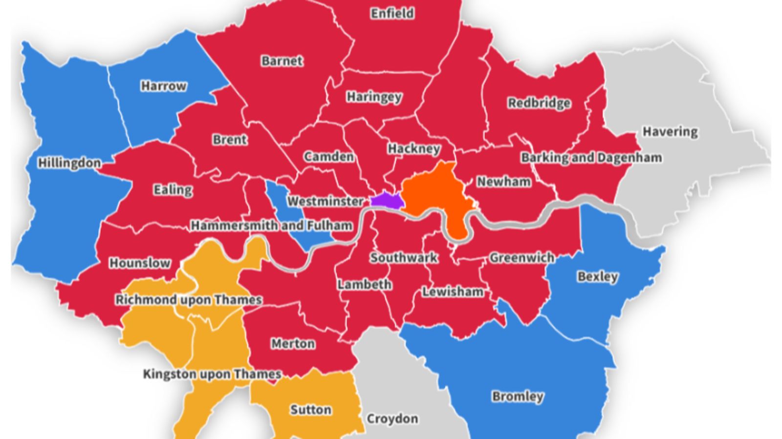
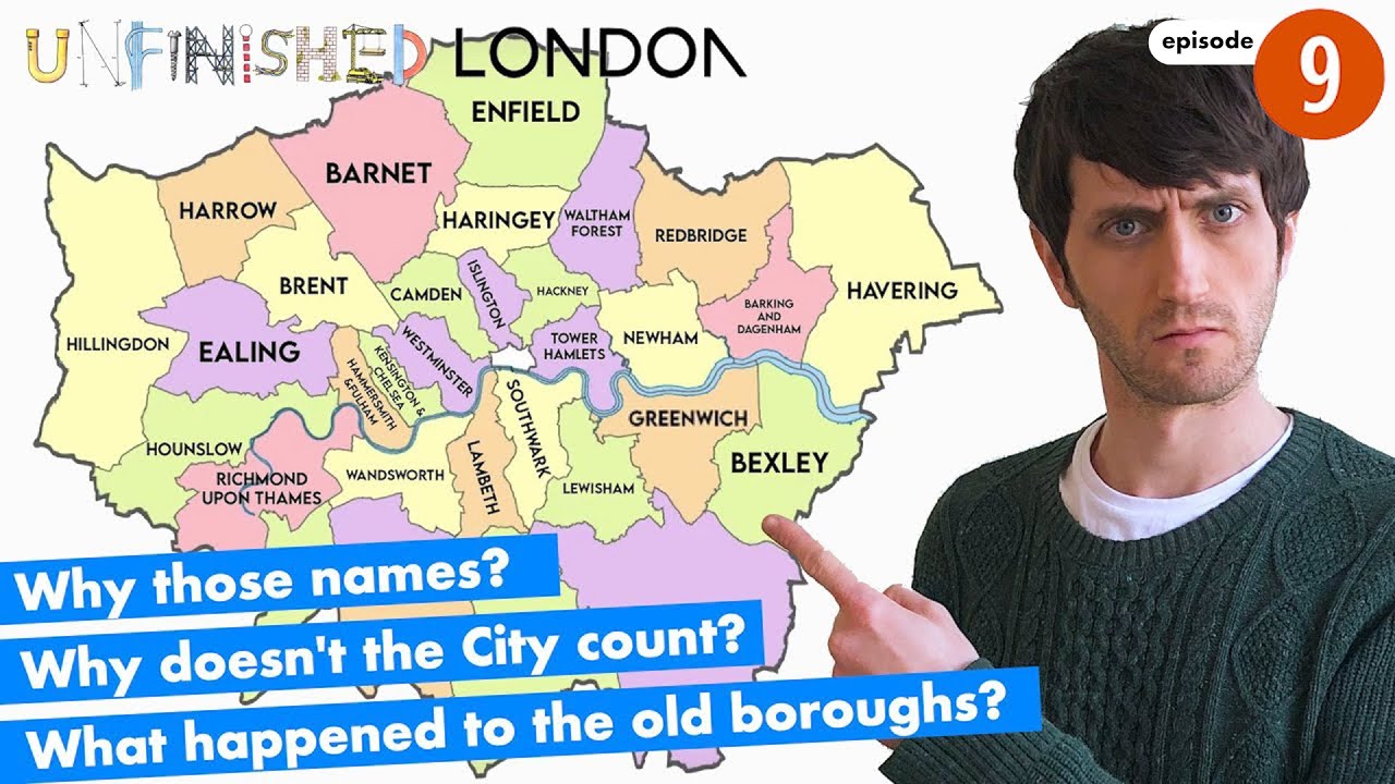
London Boroughs On The Map
Why does London have 32 boroughs?
A map is where all of this becomes practical. Once the reader knows what a borough is and what the names tend to preserve, the borough map stops looking like an arbitrary patchwork.
The Greater London Authority publishes official borough boundary data and an official borough boundary map, which makes it the best neutral reference point for anyone trying to orient themselves.
The Best Official Borough Boundary Map To Use
Use the London Datastore / GLA borough boundary map when the goal is to understand borough limits.
It is based on official Ordnance Survey boundary data rather than a tourist sketch or a lifestyle infographic.
That matters because borough names can be culturally familiar long before their exact boundaries are. An official map keeps the administrative side of the article precise.
Why A Borough Map Is Not The Same As A Street Map
A borough map shows administrative boundaries. A street map shows routes, roads, and detailed local navigation.
So when someone searches for a London boroughs map with streets, they are actually asking for two different map functions at once.
Borough maps explain governance and broad location; street maps explain how to get around inside those spaces.
How Travellers Can Use Borough Names Without Over-relying On Them
For visitors, borough names are best used as a big-picture location tool. They help you understand whether you are in Inner or Outer London, whether an area belongs to a certain council, and which broader part of the city you are reading about.
But they are not always the best day-to-day navigation tool. Travellers usually move through neighbourhood names, stations, landmarks, and postcodes more than borough labels. Use the borough to understand the map; use the neighbourhood to feel the place.
For most visitors, the real value is not memorising all 32 boroughs. It is understanding that borough names can help you read the city in broader historical and geographic layers.
The takeaway is simple: a borough map tells you how London is organised, while the names tell you why those labels often feel deeper than bureaucracy.
Don't Miss: Average Salary In London By Borough
Frequently Asked Questions
What Does Borough Mean In London?
A London borough is an official local authority area within Greater London, each run by its own council. In practical terms, it is a governing area rather than just a cultural neighbourhood name.
How Many Boroughs Are In London?
London has 32 boroughs. If you are counting all local government authorities in London, you add the separate City of London, which brings the total to 33 authorities.
Does London Have 32 Or 33 Boroughs?
It has 32 boroughs and 33 local authorities if the City of London is counted separately. The City is not one of the boroughs.
Why Is London Split Into Boroughs?
London is split into boroughs so local services can be managed across a very large capital. The borough system created the current local-authority structure for Greater London.
When Were London’s Current Boroughs Created?
The present borough structure took effect on 1 April 1965 under the London Government Act 1963.
What Are Inner And Outer London Boroughs?
They are official groupings used in planning and administration. The London Plan classifies boroughs such as Camden and Westminster as Inner London, and Barnet and Bromley as Outer London.
Is The City Of London A Borough?
No. The City of London is a separate historic local authority with its own corporation and a distinct constitutional history.
Are Boroughs The Same As Districts Or Neighbourhoods?
No. Boroughs are official council areas, while districts and neighbourhoods are looser place labels used socially, historically, or for navigation.
Where Can I Find An Official London Borough Map?
The best official source is the Greater London Authority’s London Datastore, which publishes borough boundary data and a borough boundary map.
Are London Borough Names Mostly Anglo-Saxon?
Many are, but not all. Some come from older river names, churches, titled people, or modern administrative naming choices such as Newham and Redbridge.
Which Borough Names Were Created Or Reshaped In 1965?
Newham is the clearest example of a 1965-created borough name. Composite borough names such as Barking and Dagenham also reflect how older places were joined inside the new system.
What Does Croydon Mean?
Croydon is commonly explained as the valley of the crocuses.
What Does Brent Mean?
Brent is commonly traced to an ancient Celtic river name, often glossed as holy one or high place.
What Does Westminster Mean?
Westminster means the western minster, referring to the abbey church west of the old City.
What Does Camden Mean?
Camden takes its name from Charles Pratt, 1st Earl of Camden.
What Does Lambeth Mean?
Lambeth comes from Old English lambhythe, commonly understood as the place where lambs were landed.
How Many Districts Are In London?
There is no single clean official count in the way there is for boroughs. Boroughs are formal local-authority areas; districts are broader and less consistently bounded.
Is There A Good Book About London’s Boroughs?
Yes. The Boroughs of London by Mike Hall and Matt Brown is a recent borough-by-borough reference published by Batsford, aimed at readers interested in maps, local history, and London’s varied identities.
Why The Names Matter More Than Trivia
Once the system is clear, London borough name meanings stop being pub-quiz material and start acting like map keys.
They tell you where rivers once dominated movement, where woods were cleared for settlement, where power centred on abbeys or kings, and where the 1965 borough map stitched older identities into modern councils.
That is what makes the subject worth reading properly. You do not need to memorise every borough meaning to benefit from them; you only need to recognise that London’s map is a layered text, and borough names are some of its clearest surviving sentences.
If this helped untangle the capital a little, it is the sort of piece worth saving for the next time a borough label suddenly stops looking random.
Editorial note:borough-name etymology does not have one single official source for all 32 boroughs, so the meaning sections use cautious, commonly explained as wording and standard London place-name references alongside primary governance sources.
Also Check Out: Why London Is So Expensive
Jump to
London Borough Name Meanings: A Clear Guide To The History Behind The Map
What A London Borough Actually Is
Why London Is Split Into Boroughs
How To Read London Borough Name Meanings
London Borough Name Meanings By Pattern, Not Just By Alphabet
The Full Quick-reference Table Of All 32 London Borough Name Meanings
What These Names Reveal About London’s Past
London Boroughs On The Map
Frequently Asked Questions
Why The Names Matter More Than Trivia

James Rowley
Author
James Rowley is a London-based writer and researcher covering London life, cultural geography, London travel, live London webcam pages and selected public figures across entertainment, sport, business and public life.
For over 15 years, he has focused on verified sources, first-hand local context and clear explanations that help readers understand both places and people more deeply. His work combines street-level London knowledge with careful research into career credits, media work, business interests and, where relevant, transparently explained net worth estimates.
He writes and reviews articles published on LondonWebcam.
Latest Articles
Popular Articles