London’s Busiest Intersections | Walk, Tube Or Taxi?
Plan around London’s busiest intersections with advice on Oxford Circus, Piccadilly Circus, Bank, Hanger Lane, Tube routes, webcams and taxis.
Author:James RowleyMay 21, 2026
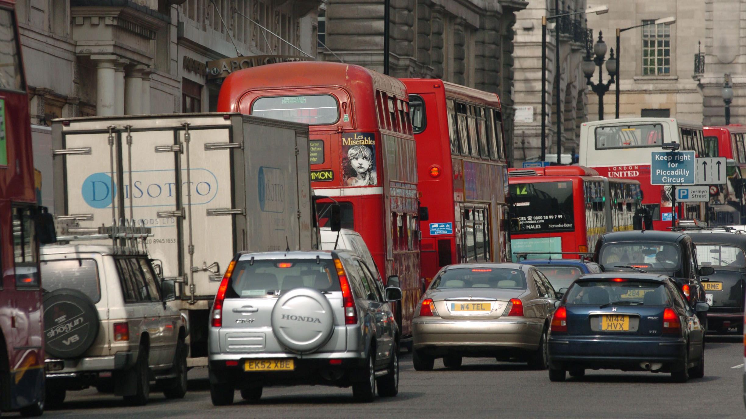
Which London Intersection Is Actually The Busiest?
If you are moving through central London, the best transport choice is usually simple: walk short West End journeys, use the Tube or Elizabeth line for longer cross-city trips, take the bus when price and views matter more than speed, and avoid driving unless you have a specific reason.
If the views are part of the reason you are considering the bus, London bus journey live streamscan also help you preview what travelling through the capital looks like from road level.
Buses are the cheapest standard public transport option: TfL lists the adult pay-as-you-go bus fare as £1.75, with a bus and tram daily cap of £5.25. Driving into the Congestion Charge zone can quickly become expensive: TfL lists the daily charge as £18 if paid on the day of travel or in advance, or £21 if paid within three days after travel. These figures were checked in 2026, but travellers should confirm current fares and charges with TfL before travelling.
| If your priority is... | Best option |
| Lowest price | Bus, especially for one or more short journeys. |
| Fastest cross-city journey | Tube, Elizabeth line, DLR or rail. |
| Short West End hop | Walk, especially between nearby stations. |
| Luggage, late-night travel or accessibility needs | Taxi or step-free planned public transport. |
| Driving into central London | Check Congestion Charge, ULEZ, parking and restrictions first. |
That transport choice matters because London does not have one simple “busiest intersection”. A junction can be crowded with shoppers, clogged with vehicles, busy with commuters, full of tourists taking photos, or controlled by complex restrictions.
The useful answer is not just a name. It is knowing which kind of busy you are dealing with, when it peaks, and how to route around it without losing time.
For a fuller beginner-friendly breakdown of Tube, bus, walking and cab choices, see this guide to how to get around London.
Key takeaways
- Oxford Circus is the strongest answer for London’s busiest pedestrian-focused intersection.
- Piccadilly Circus is one of London’s best-known busy junctions for visitors, photos and West End movement.
- Bank Junction is the best example of a heavily managed City of London movement point.
- Hanger Lane Gyratory is one of London’s clearest road-traffic complexity examples.
- Walking or the Tube often beats taxis through central London at peak times.
The Quick Answer: Which London Intersection Is Busiest?
If you mean footfall, Oxford Circus is the best practical answer. It sits where Oxford Street and Regent Street meet, directly above a major Tube station, in the middle of London’s main shopping corridor.
If you mean road traffic and driver complexity, Hanger Lane Gyratory is a stronger candidate. If you mean tourist recognition, Piccadilly Circus is usually the strongest practical example. If you mean weekday commuter management, Bank Junction deserves special attention.
London does not appear to publish one official ranking that combines pedestrians, vehicles, buses, taxis, Tube exits and tourist crowding. That is why this guide separates the evidence into footfall, road traffic, commuter movement, visitor crowding and live observation.
For road traffic, the strongest official evidence comes from Department for Transport data. The DfT’s London road traffic dashboardreports 19.4 billion vehicle miles in London in 2024, while London Datastore states that its borough traffic-flow dataset uses DfT National Road Traffic Survey data. Those are vehicle measures, not pedestrian-count measures.
For footfall, older official city context is still useful but should be handled carefully. London City Hall stated in 2016 that 500,000 pedestrians walked Oxford Street every day, alongside four Tube stations and heavy bus and taxi activity. That is historical official context, not a live 2026 count.
Which Intersections Are Busiest In London?
This shortlist helps you decide which junction matters for your journey, your photos, your taxi route or your walking plan.
| Intersection | Why it matters; busiest time; nearby station/webcam |
| Oxford Circus | Major pedestrian pressure point where Oxford Street meets Regent Street. Usually busiest during shopping peaks, lunch hours, evening rush and Saturdays. Nearby station: Oxford Circus. Nearby camera: Oxford Circus webcam context is available through LondonWebcam. |
| Piccadilly Circus | London’s most recognisable busy junction for tourists, theatres, screens, photos and West End movement. Usually busiest in afternoons, evenings, weekends and theatre times. Nearby station: Piccadilly Circus. |
| Bank Junction | Dense City of London junction shaped by office commuters, buses, cyclists, pedestrians and traffic restrictions. Busiest on weekdays, especially commuting hours. Nearby station: Bank. |
| Hanger Lane Gyratory | Major road-traffic and driver-complexity point in west London, associated with the A406 and A40 approaches. Busiest during commuting peaks and disruption. Nearby station: Hanger Lane. |
| Hyde Park Corner / Marble Arch | Big edge-of-West-End movement points, especially for traffic, park access, hotels, buses and shopping routes. Busiest during commuting peaks, events and weekends. Nearby stations: Hyde Park Corner and Marble Arch. |
| St Giles Circus / Tottenham Court Road | Important eastern Oxford Street and Charing Cross Road movement point, shaped by shopping, buses, theatres, offices and Tottenham Court Road station. Busiest during shopping, commuting and West End peaks. |
How We Judged “Busiest”: Road Traffic Vs Footfall
“Busiest” can mean several things in London, so this guide separates pedestrian pressure, vehicle traffic, commuter flow, tourist crowding and live visual observation.
For road traffic, the most useful official sources are Department for Transport traffic data, London Datastore transport datasetsand TfL road-management information. For pedestrian pressure, the article uses official city context, landmark layout, station proximity, retail corridors and known visitor movement patterns.
Oxford Circus: London’s Pedestrian Pressure Point
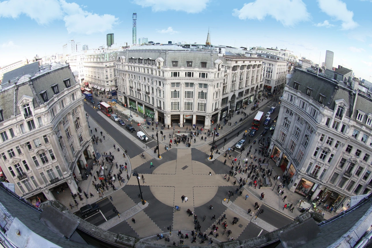
Oxford Circus matters because it compresses shopping, commuting, buses, taxis, Tube entrances, tourists, office workers and street crossings into one small surface space. It is not just a crossroads; it is a pressure valve for the West End.
The Oxford Circus camera page describes the location as the junction of Oxford Street and Regent Street, with a Tube station there and a camera looking down Regent Street towards Piccadilly Circus. That live context is useful because footfall can shift quickly with weather, sales, demonstrations, Christmas lights and Tube disruption.
Road traffic vs footfall: For most visitors, Oxford Circus matters because of pedestrian pressure, Tube exits and shopping crowds.
Piccadilly Circus: A Best-Known Busy Junction For Visitors
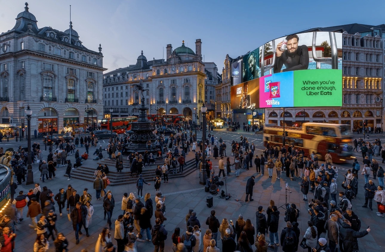
Piccadilly Circus is the junction people recognise before they understand London’s road network. The screens, the Shaftesbury Memorial Fountain, commonly known as Eros, Theatreland, Regent Street, Shaftesbury Avenue, Leicester Square and Soho all feed movement into the area.
It feels busy because people do not simply pass through. They stop, meet, photograph, look for restaurants, check maps, cross towards theatres and drift between Soho, Leicester Square and Regent Street.
If you want to see the area before heading there, the Piccadilly Circus live webcamgives a current view of one of the West End’s busiest meeting points.
Road traffic vs footfall: Piccadilly Circus often feels crowded because visitors stop, gather, photograph and move between nearby West End streets.
Bank Junction: The City’s Managed Movement Puzzle
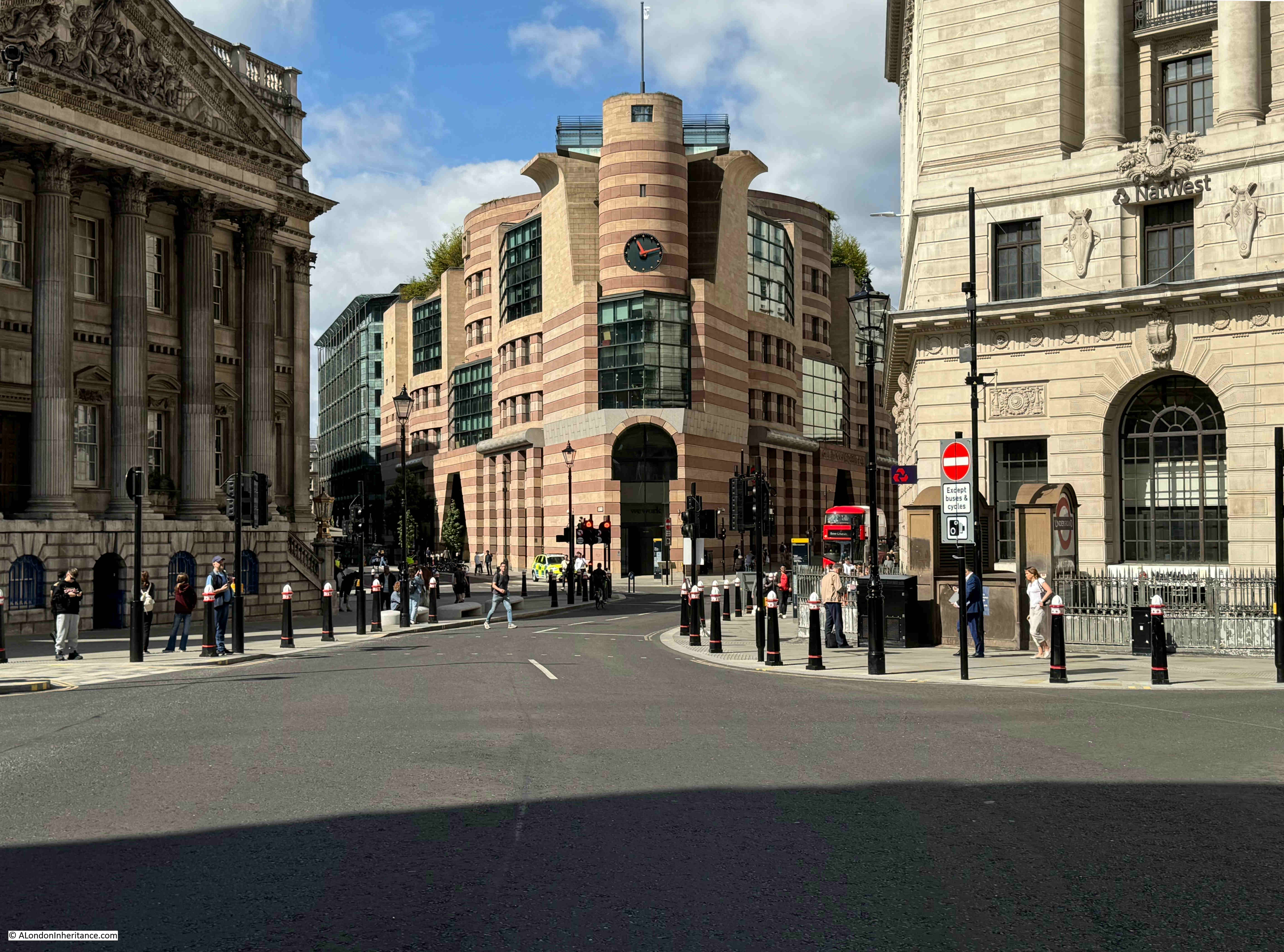
Bank Junction shows how London handles movement when old streets meet modern commuting. This is not a relaxed sightseeing junction; it is a working-city interchange shaped by office flows, cycle routes, buses, narrow approaches and traffic restrictions.
Bank is also important because the City of London’s workday rhythm is sharp. It can feel calmer outside office hours and far more compressed during weekday peaks.
Road traffic vs footfall: Bank’s pressure comes mainly from weekday commuting, buses, cyclists, pedestrians and traffic restrictions.
Hanger Lane Gyratory: The Vehicle-Complexity Candidate
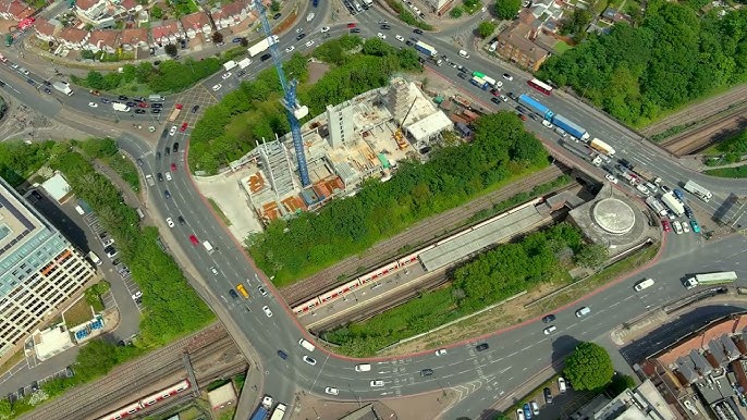
Hanger Lane Gyratory belongs in the conversation because, for drivers, “busy” often means complex signalling, heavy approach roads and the risk of slow-moving traffic.
In a 2022 FOI response, TfL stated that Hanger Lane’s signal timings were designed to protect the gyratory from locking up during busy periods. TfL said this was achieved using SCOOT, an automated signal system that adjusts timings in real time based on traffic detected by road sensors.
For visitors, Hanger Lane is rarely a sightseeing stop. For drivers, taxi routes, delivery vehicles and airport-edge journeys, it can matter a great deal.
Road traffic vs footfall: For drivers, the issue is route complexity rather than sightseeing crowds.
Hyde Park Corner, Marble Arch And Other Major Junctions
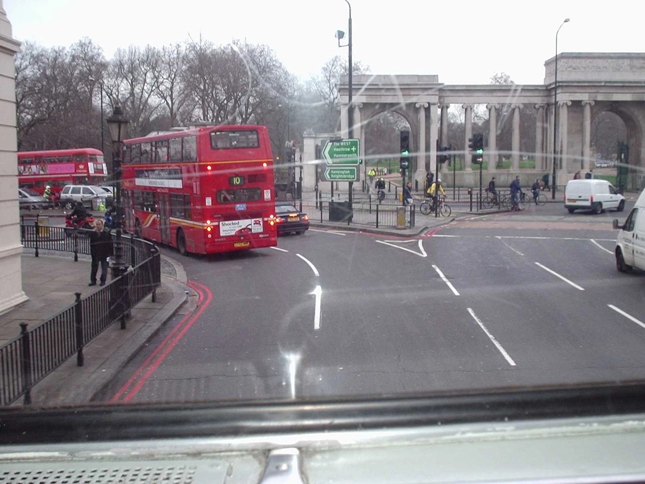
Hyde Park Corner and Marble Arch are major movement points because they sit at the edge of parks, hotels, shopping streets, bus corridors and central road routes. They can become awkward during events, marches, Christmas shopping, roadworks or park gatherings.
St Giles Circus and Tottenham Court Road should also be part of the conversation. They catch eastern Oxford Street movement, Charing Cross Road traffic, Tottenham Court Road station demand and West End pedestrian flow. They are not the cleanest “busiest intersection” answer, but they complete the Oxford Street corridor from Marble Arch through Oxford Circus to the eastern West End.
These places are not always the “busiest” by one metric, but they explain London’s pattern: busy intersections often sit where tourism, through-traffic, public transport and landmark geography collide.
The useful move is to stop asking only “which one is busiest?” and start asking “busy for whom?”
London Has Different Kinds Of “Busy”
Two London junctions can look equally crowded but create completely different travel problems. Reading the type of busy helps you choose the right route.
Pedestrian Busy
Pedestrian-busy junctions are shaped by shoppers, tourists, commuters, Tube exits and short walking trips. Oxford Circus and Piccadilly Circus are the clearest examples.
A common mistake is treating pedestrian crowding like road congestion. Footfall can spike because a Tube train has just unloaded, a theatre has just ended, or rain has pushed everyone under the same narrow shopfronts.
Vehicle Busy
Vehicle-busy junctions are shaped by road hierarchy, signal timing, turning movements, bus lanes, taxis, delivery access and restrictions. Hanger Lane sits in this category.
TfL says its red routes make up only 5% of London’s roads but carry up to 30% of the city’s traffic, which explains why a small number of strategic roads can carry disproportionate pressure.
Tourist Busy
Tourist-busy places are not always the highest-volume roads. They are places where people slow down, take photos, look up, check maps, wait for friends or hesitate before crossing.
Piccadilly Circus, Trafalgar Square, Oxford Circus, Leicester Square and nearby West End streets all work this way.
Commuter Busy
Commuter-busy places peak sharply. They can feel calm at 11am and intense at 8:45am or 5:45pm.
Bank Junction is a strong example because the City of London’s workday rhythm shapes the surface streets around a major Underground and DLR interchange.
Road-Safety Busy
A junction can be busy because authorities focus safety work there, not because it is pleasant or famous. TfL and the Mayor launched a new Vision Zero road safety plan in March 2026, with actions aimed at reducing road danger and preventing deaths and serious injuries on London’s roads.
How Traffic Patterns Change By Time Of Day
London’s busiest intersectionschange character through the day. Knowing the rhythm can save more time than memorising a list of junction names.
Morning Rush Hour: Commuters, Deliveries And School Runs
Morning pressure is strongest around office districts, rail termini, school routes, bridges and arterial roads. Bank, London Bridge approaches, Victoria, King’s Cross and major road corridors can feel sharper than tourist zones early in the day.
For road traffic, this is when small disruptions matter. One blocked lane, badly timed delivery, illegal stopping point or minor incident can ripple across nearby streets.
Lunchtime And Shopping Peaks
Lunchtime changes the map. Office workers leave buildings, shoppers arrive, food streets fill and visitors start moving between attractions.
Oxford Circus, Oxford Street, Regent Street, Soho, Covent Gardenand Leicester Square can feel heavier on foot even when the worst vehicle traffic is elsewhere.
Evening Rush Hour And Theatre Crowds
Evening brings two waves at once: commuters leaving work and visitors arriving for dinner, theatre, pubs, shops and events. Piccadilly Circus and Shaftesbury Avenue can feel especially crowded because the West End pulls people in while commuters are still moving out.
This is often when taxis become tempting but slow. The short ride on the map may sit inside the densest part of the city.
Weekends, Bank Holidays And Event Days
Weekend London has a different pattern. Office junctions can relax, while shopping, parks, markets, museums, football grounds and event routes surge.
TfL Go is useful because it shows live routes, disruptions, arrivals and step-free journey options across London’s transport network.
Why West End Crowds Behave Differently From Road Traffic
West End crowding is not linear. People stop suddenly, drift diagonally, queue outside shops, gather near crossings and pause under signs or screens.
That is why Oxford Circus and Piccadilly Circus can feel “busier” than a road with more vehicles. The delay is often caused by movement friction, not just volume.
What The Busiest Junctions Tell You About Movement In The City
London’s crowded junctions make more sense when you understand that the city has several centres, not one simple downtown grid.
London Is Not Built Around One Centre
London has many centres: the West End, the City, Westminster, Canary Wharf, South Bank, King’s Cross, Stratford, Kensington and more. That makes movement more complex than a city with one obvious downtown grid.
The Tube map can also make places look farther apart than they are. In central London, walking one stop is often quicker than going down to a platform, waiting, riding, changing and coming back up.
Shopping, Work, Tourism And Through-Traffic Overlap
Oxford Circus shows shopping plus commuting. Piccadilly Circus shows tourism plus nightlife. Bank shows work plus managed transport. Hanger Lane shows through-traffic plus road-network pressure.
For route planning, identify the dominant pressure: shopping, commuting, tourism or through-traffic.
Why Tube Stations Make Surface Junctions Feel Busier
A Tube station adds pulsed movement. Every train arrival releases a wave of people who surface at the same exits and meet shoppers, buses, taxis, cyclists and crossings.
That is why a junction above a major station can feel crowded even when road traffic is moving normally.
What Busy Intersections Reveal About London’s Street Design
London’s streets evolved from old lanes, markets, estates, royal routes, bridges and later motor roads. That history creates charm, but it also creates tight junctions where modern demand exceeds the shape of the street.
A rectangular grid absorbs movement. London often funnels it.
Oxford Street Vs Oxford Circus: Don’t Confuse The Street With The Junction
Oxford Street is the corridor. Oxford Circus is the crossing point. That distinction prevents one of the most common misunderstandings.
Oxford Street As A Crowded Shopping Corridor
Oxford Street is one of London’s major retail streets. London City Hall stated in 2016 that 500,000 pedestrians walked Oxford Street every day, with four Tube stations along the street and heavy bus and taxi activity.
That number should be handled carefully. It is an older official figure, not a live count. The pattern still matters: Oxford Street is a pedestrian corridor first.
If shopping is the reason for your trip, plan around Best Shopping Areas In Londonrather than bouncing between distant districts.
Oxford Circus As The Key Crossing Point
Oxford Circus is where Oxford Street and Regent Street meet. That makes it the pinch point where two major shopping routes cross above an important Tube station.
A person asking for London’s busiest intersection usually wants Oxford Circus, not the whole of Oxford Street.
How Pedestrianisation Plans May Change The Area
Oxford Street’s layout is in an active change process. TfL’s latest Oxford Street transport and highway materials cover changes intended to enable pedestrianisation of Oxford Street West, between Orchard Street and Great Portland Street. TfL says the earlier Oxford Street Transformation consultation has closed and a consultation report has been published.
For readers, the important point is practical. Bus routes, taxi access, deliveries, cycling and walking patterns may all shift as plans progress.
Treat Oxford Street access details as volatile until official changes are complete.
How To Avoid Delays If You Are Walking, Driving Or Taking A Taxi
You do not need to avoid central London. You need to choose the right mode for the right distance at the right time.
If You Are Walking: Use Parallel Streets And Shortcuts
Walking is often the best way through the West End, especially for short hops between Oxford Circus, Piccadilly Circus, Soho, Bond Street, Leicester Square and Tottenham Court Road.
Alternative walking tips
- Use side streets when Oxford Street is packed.
- Walk one Tube stop in central areas when stations are crowded.
- Avoid stopping at crossing mouths to check your phone.
- Step away from the main pavement flow before taking photos.
- Give yourself extra time around Christmas lights, sales and theatre hours.
If You Are Driving: Check Restrictions, Charges And Peak Times
Driving into central London adds cost, rules and uncertainty. TfL says the Congestion Charge is £18 if paid on the day of travel or in advance, or £21 if paid within three days after travel. It applies during charging times in the Congestion Charge zone.
Ultra Low Emission Zone (ULEZ) is separate. TfLsays vehicles that do not meet ULEZ emissions standards and are not exempt need to pay a £12.50 daily charge to drive within the zone.
If You Are Taking A Taxi: Avoid West End Bottlenecks At Peak Times
A taxi can be useful late at night, with luggage, in poor weather, or for door-to-door accessibility. It can also crawl through the West End when walking or the Tube would be faster.
Before choosing a cab for comfort rather than speed, compare London Taxi Vs Uber Vs Bolt costfor your exact journey type.
A common route-planning mistake is choosing a taxi for a short central hop because the map distance looks tiny. In London, the shortest road route can still cross the slowest junctions.
When Walking Or The Tube Is Faster Than A Cab
For central London, use this quick rule.
| Journey choice | Best use |
| Walk | Short West End journeys, one-stop Tube hops and crowded shopping areas. |
| Tube | Longer cross-city movement, especially across Zone 1. |
| Bus | Lower-cost scenic travel when speed is not the priority. |
| Taxi | Luggage, late travel, accessibility needs or awkward routes. |
| Drive | Only when you have a specific reason and have checked charges. |
Quick Decision Table: Walk, Tube, Bus, Taxi Or Drive?
Use this simple decision filter before you move.
| Situation | Best option |
| One or two central stops | Walk first, especially in the West End. |
| Crossing London quickly | Tube, Elizabeth line or rail. |
| Budget sightseeing | Bus, if you are not in a rush. |
| Heavy luggage or mobility needs | Taxi or step-free planned public transport route. |
| Entering central London by car | Check Congestion Charge, ULEZ, parking and restrictions first. |
The best delay-avoidance habit is to plan the mode first, not the route first.
How To Get Around London’s Busiest Intersections
The right mode changes with distance, time, weather, luggage, accessibility needs and crowding. Start with the journey type, then choose the transport.
Use The Tube For Longer Cross-City Trips
The Tube is usually the cleanest answer for longer central journeys. Use it for cross-city trips, not every tiny West End hop.
Going underground for a short journey can waste time if the stations are busy, the interchange is awkward or the walking distance between platforms is long.
For longer journeys, it also helps to know the quietest times to travel on the Tube, especially with luggage, children or step-free needs.
Walk Short Central London Journeys
Walking is often underrated because the Tube map distorts distance. Oxford Circus to Piccadilly Circus, Piccadilly Circus to Leicester Square, and Leicester Square to Covent Garden are journeys where walking may feel more natural than changing lines.
Walking also gives you control. If one pavement is packed, you can move one street over.
Use Buses When You Want A Cheaper Scenic Route
London buses are useful when you want to see the city, avoid stairs or keep costs predictable. Visit London describes buses as a convenient and cheap way to travel around the city, and its 2026 bus guide lists the adult single fare as £1.75 and the bus and tram daily cap as £5.25.
The trade-off is speed. A bus through Oxford Street, Regent Street or Piccadilly can be slow during busy periods.
If you are choosing the bus for price or views, check the quietest time to travel on London busesbefore relying on a central route.
Avoid Taxis Through The West End At Peak Times
A taxi is not automatically premium travel if it spends twenty minutes edging around a junction. For short central trips during peak times, think of taxis as comfort-first, not speed-first.
The best time to use a taxi near the busiest junctions is when your journey has a practical need: luggage, tired children, reduced mobility, late-night travel, rain or an awkward destination.
Check TfL Maps Before You Travel
TfL Go can show live routes, arrivals, disruption information and step-free journey options. It can also adapt step-free suggestions around current line or lift closures.
The smartest London route is the one that reacts to the day, not the one you memorised yesterday.
Nearby Webcams And Transport Alternatives
Webcams are not a replacement for official travel status, but they are useful for seeing how a place feels right now. Pair them with TfL tools for a stronger decision.
For a more detailed routine, see this guide to London live webcams to check traffic and weatherbefore you set off.
How Live Webcams Can Help You Check Crowd And Traffic Conditions
A live or near-live camera can show queues, road surface conditions, weather and crowd feel. Use webcams as observation, not proof of long-term traffic volume.
A quiet camera at 10am does not mean the junction is quiet at 6pm. It only tells you what the area looks like now.
Nearby Tube Stations For Each Busy Junction
Match the junction to the nearest practical station, but check step-free access and line status before you commit.
| Area | Nearby transport alternative |
| Oxford Circus | Oxford Circus station; consider Bond Street or Tottenham Court Road if pavements are packed. |
| Piccadilly Circus | Piccadilly Circus station; consider Green Park, Leicester Square or walking via Soho. |
| Bank Junction | Bank station; consider Monument, Cannon Street, Mansion House or Liverpool Street depending on direction. |
| Hanger Lane | Hanger Lane station; drivers should check TfL road updates before approaching. |
| Marble Arch / Hyde Park Corner | Marble Arch, Bond Street, Hyde Park Corner, Green Park or park-edge walking routes. |
| St Giles Circus / Tottenham Court Road | Tottenham Court Road station; consider Leicester Square, Holborn or walking via Soho/Fitzrovia depending on direction. |
Bus Alternatives Around Central London
Buses can be helpful if you want fewer stairs or a slower scenic route. They are less helpful when your route cuts through the same traffic pressure you are trying to avoid.
Use TfL bus maps and live arrivals rather than assuming a bus is delayed simply because the road looks busy.
Walking Alternatives Between Major West End Junctions
West End walking works best when you use parallel routes. Around Oxford Street, stepping into Mayfair, Soho, Fitzrovia or Marylebone can change the feel of the journey quickly.
| If this area is crowded | Try this instead |
| Oxford Circus | Bond Street, Tottenham Court Road or a side-street walking route. |
| Piccadilly Circus | Green Park, Leicester Square or walking via Soho. |
| Bank Junction | Monument, Cannon Street, Mansion House or Liverpool Street. |
| Marble Arch | Bond Street or park-edge walking routes. |
| Hanger Lane | Check TfL road updates before approaching. |
| St Giles Circus / Tottenham Court Road | Holborn, Leicester Square, Soho or Fitzrovia walking routes. |
When To Change Route Before You Arrive
Change route before you reach the bottleneck if a webcam, TfL status update, event, weather shift or road closure suggests pressure ahead. Waiting until you are already in the crowd gives you fewer choices.
Tourist hotspots that commonly create congestion include major shops, theatre exits, Christmas lights, museums, parks, screens and landmark photo points.
The best London travellers make small adjustments early.
Oyster, Contactless And London Transport Tips For Tourists
Payment mistakes can create avoidable stress at the exact moment you are entering a busy station. Get this right before you hit Oxford Circus or Piccadilly Circus.
Should Tourists Use Oyster Or Contactless?
Transport for Londonsays pay as you go is the easiest way to pay for London travel, and visitors can use contactless, Oyster or Visitor Oyster. It also says pay as you go is cheaper than buying single tickets and includes daily and weekly capping.
Contactless is usually easiest if your card or device works reliably in the UK. Visitor Oyster can suit travellers who prefer preloaded credit or do not want to use a bank card.
For a deeper tourist payment comparison, compare Oyster vs contactless in Londonbefore choosing how to pay.
How Daily Caps Work At A High Level
Capping means there is a limit to what you pay for eligible travel in a day or week. TfL says pay-as-you-go caps and Travelcard prices are frozen until 2027, while Tube, DLR and rail pay-as-you-go fares rose from 1 March 2026.
Do not build a travel budget from an old blog post. Use TfL for exact prices.
Tap In And Out With The Same Card Or Device
Use the same card or device for the whole journey. TfL tells visitors to use the same card or device to touch in and out so they pay the right fare; buses and trams require touch-in only.
A physical card and the same card in a phone wallet can be treated as different payment methods, so keep it consistent.
Common First-Time Tube Mistakes
The mistakes are simple and costly in time:
- Entering a station for a one-stop journey that is faster on foot.
- Tapping with one card and leaving with another.
- Standing on the left of escalators instead of letting people pass.
- Ignoring step-free route needs until reaching the station.
- Travelling through Oxford Circus at the busiest times without checking alternatives.
Good payment habits make crowded stations far easier to handle.
Mini London Travel Guide: Busy Junctions By Visitor Scenario
Different visitors need different advice. The best route for a shopper is not always the best route for a commuter, driver or step-free traveller.
If You’re Shopping
Start early if you want calmer pavements around Oxford Circus, Regent Street and Oxford Street. Saturday afternoons, Christmas shopping periods, large sales and bad-weather windows are usually heavier.
Use Bond Street or Tottenham Court Road as alternatives when Oxford Circus feels too compressed.
If You’re Sightseeing
Piccadilly Circus, Leicester Square, Trafalgar Square, Covent Garden and the West End work best as a walking cluster. Avoid using taxis between every stop unless you have a mobility, luggage or timing reason.
A slower walking route may be more enjoyable than sitting in traffic beside the place you came to see.
If You’re Commuting
Commuters should think in terms of reliability. A slightly longer route with fewer crowd pinch points may beat the theoretically fastest interchange.
Check TfL Go before leaving, especially during strikes, engineering works, severe weather or major events.
If You’re Driving
Drivers should treat central London as a rules-first environment. Check Congestion Charge, ULEZ, parking, red routes, loading restrictions and planned works before setting off.
TfL’s red route rules matter because strategic roads carry a disproportionate share of London’s traffic.
If You Need Step-Free Or Lower-Crowd Routes
Prioritise step-free planning over shortest-route planning. TfL Go includes step-free route planning and can adapt suggested journeys around current disruptions such as line closures or lift closures.
For lower-crowd travel, shift time first. Early mornings, mid-mornings and later evenings can be easier than peak windows, though event days can override normal patterns.
The best route is the one that fits your body, luggage, time and tolerance for crowds.
Are London’s Busiest Intersections Dangerous?
Busy junctions deserve attention, but the word “busy” should not automatically make you anxious. The real question is how a junction is designed, managed, signalled and used.
Busy Does Not Always Mean Dangerous
A crowded crossing with clear signals, good visibility and predictable pedestrian phases may feel intense but function well. A less famous junction with faster traffic and awkward turns may create more risk.
Separate feeling crowded from being unsafe.
Why TfL’s Vision Zero Work Matters
TfL and the Mayor launched a new joint Vision Zero road safety plan in March 2026, with 43 actions aimed at reducing road danger over the next five years. The plan is designed to help prevent deaths and serious injuries on London’s roads.
This is why official safety programmes are more useful than casual rankings. A junction that trends online as “scary” may not tell the full evidence story.
How To Cross Safely As A Visitor
Use simple habits at busy London junctions:
- Wait for the pedestrian signal.
- Check turning traffic even when others step out.
- Do not stop at the mouth of a crossing.
- Keep phones away while crossing.
- Move aside before checking maps or taking photos.
- Follow temporary signs during roadworks or events.
A safer traveller is predictable, visible and unhurried.
Frequently Asked Questions: London’s Busiest Intersections
What Are The Busiest Intersections In London?
The main busy intersections to know are Oxford Circus, Piccadilly Circus, Bank Junction, Hanger Lane Gyratory, Hyde Park Corner, Marble Arch and St Giles Circus/Tottenham Court Road. Each creates a different travel problem, from shopping crowds to road complexity.
When Is Central London Traffic Worst?
Central London is usually hardest during weekday morning and evening peaks, Saturday shopping periods, theatre changeover times, major events and bad-weather surges.
Which Areas Are Easiest To Avoid At Peak Times?
Avoid Oxford Circus, Piccadilly Circus, Bank, major station approaches and West End shopping streets at peak times if your journey does not require them. Nearby parallel streets and alternative stations often reduce pressure.
What Is London’s Busiest Road?
There is no single useful answer without a metric. DfT traffic data measures vehicles by road links and regions, while pedestrian-heavy streets like Oxford Street are measured differently.
What Is The Most Crowded Street In London?
Oxford Street is usually treated as London’s most crowded shopping street. London City Hall stated in 2016 that 500,000 pedestrians walked Oxford Street every day, but that figure should be treated as historical official context, not a live count.
Is Oxford Circus Busier Than Piccadilly Circus?
For pedestrian pressure tied to shopping and Tube exits, Oxford Circus is usually the stronger answer. For tourist recognition, photos and West End gathering, Piccadilly Circus feels more famous.
What Is The Easiest Way To Get Around London?
Use the Tube for longer trips, walk short central journeys and use buses for cheaper scenic travel. For live disruption, arrivals and step-free planning, use TfL Go.
Should Tourists Use Oyster Or Contactless?
Contactless is easiest if your card or device works reliably. Visitor Oyster is useful if you prefer preloaded travel credit. TfL supports pay as you go through contactless, Oyster and Visitor Oyster.
What Tube Mistakes Do First-time Visitors Make?
Common mistakes include taking the Tube for very short central trips, tapping with different cards or devices, blocking escalators, ignoring step-free needs and travelling through the busiest stations at peak times.
When Is Public Transport Better Than Taxis?
Public transport is often better through central London during rush hour, Saturday shopping peaks, West End theatre times and road disruption. Taxis still help with luggage, accessibility needs, late nights or awkward door-to-door journeys.
Is Hanger Lane Gyratory In Central London?
No. Hanger Lane Gyratory is in west London, not the central sightseeing core. It matters mainly for drivers and road traffic, especially around A406 and A40 movement.
Is Oxford Street Being Pedestrianised?
TfL’s latest Oxford Street transport and highways consultation focuses on changes to enable pedestrianisation of Oxford Street West, between Orchard Street and Great Portland Street. Details can change, so verify official updates before relying on route advice.
Final Thought
London’s busiest intersections are not all busy in the same way. Oxford Circus is the best pedestrian answer, Piccadilly Circus is the visitor-recognition answer, Bank Junction is the managed commuter answer, and Hanger Lane Gyratory is the driver-complexity answer.
The smartest way around them is practical: walk short central trips, use the Tube for longer ones, check TfL before you travel, use webcams for live visual context, and avoid taxis through the West End when surface traffic is doing exactly what London surface traffic does.
Jump to
Which London Intersection Is Actually The Busiest?
The Quick Answer: Which London Intersection Is Busiest?
Which Intersections Are Busiest In London?
How We Judged “Busiest”: Road Traffic Vs Footfall
Oxford Circus: London’s Pedestrian Pressure Point
Piccadilly Circus: A Best-Known Busy Junction For Visitors
Bank Junction: The City’s Managed Movement Puzzle
Hanger Lane Gyratory: The Vehicle-Complexity Candidate
Hyde Park Corner, Marble Arch And Other Major Junctions
London Has Different Kinds Of “Busy”
How Traffic Patterns Change By Time Of Day
What The Busiest Junctions Tell You About Movement In The City
Oxford Street Vs Oxford Circus: Don’t Confuse The Street With The Junction
How To Avoid Delays If You Are Walking, Driving Or Taking A Taxi
How To Get Around London’s Busiest Intersections
Nearby Webcams And Transport Alternatives
Oyster, Contactless And London Transport Tips For Tourists
Mini London Travel Guide: Busy Junctions By Visitor Scenario
Are London’s Busiest Intersections Dangerous?
Frequently Asked Questions: London’s Busiest Intersections
Final Thought

James Rowley
Author
James Rowley is a London-based writer and researcher covering London life, cultural geography, London travel, live London webcam pages and selected public figures across entertainment, sport, business and public life.
For over 15 years, he has focused on verified sources, first-hand local context and clear explanations that help readers understand both places and people more deeply. His work combines street-level London knowledge with careful research into career credits, media work, business interests and, where relevant, transparently explained net worth estimates.
He writes and reviews articles published on LondonWebcam.
Latest Articles
Popular Articles