

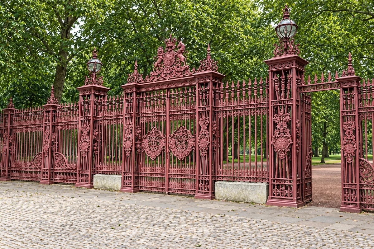
Can you see through the boundary?
The gate and railings make the park edge clear while the foliage conceals much of what lies beyond. The threshold is visible; conditions inside the park are not. This study is useful precisely because it shows the limit of the view.
Choose the boundary first
Parks are usually viewed from inside, but a street camera can only ever offer the edge. That is not a small subject. A boundary is where a park meets a city street, and it is made of ordinary things worth naming: railings, gates and openings, tree lines, open lawns, and the paths that lead inwards. The first decision is not which camera to open but which of those conditions you want to study.
Three London park edges sit beside cameras in the collection. Green Park has a Piccadilly edge, with the Piccadilly–Green Park camera nearby. Kensington Gardens has a southern edge along Kensington High Street, with the Kensington High Street camera beside it. Battersea Park has a riverside approach, with the Albert Bridge–Battersea camera at hand. In each case the official map is the primary source and the camera is optional.
Naming the boundary before opening anything keeps the exercise honest. If you start from the camera, you will describe whatever happens to be in the frame and call it the park. If you start from the boundary condition, you already know what you are looking for and can say whether the street view supplies it.
What the maps answer
The Royal Parks map places Green Park’s Piccadilly edge and describes the park’s horticultural character: no formal flower beds, but The Queen’s Meadow, opened as the 90th Coronation Meadow and commemorating Queen Elizabeth II’s 90th birthday, along with spring daffodils and mature trees. That is landscape character at the level a map and a park page can establish.
Historic England places Kensington Gardens immediately west of Hyde Park, with Kensington High Street and Kensington Gore making up the south boundary. Wandsworth describes Battersea Park as a 200-acre Victorian park built between 1854 and 1870, with a riverside promenade, a large lake and pedestrian access at Albert Bridge Road. The official maps published by The Royal Parks and Wandsworth are the sources for the shapes and entrances.
These sources establish the boundary, the named landscape and the existence of a feature. They do not tell you what a particular camera frame contains. That division is the whole point of keeping a map open beside a street view: one answers what is there, the other answers what the road position can see of the edge.
What the street adds
These feeds do not provide a reliable interior survey. They are fixed street views, positioned for the road rather than for the park. A boundary detail can still be read: a railing, a tree line, an opening, or the point where the pavement meets the park edge. That visible edge is a genuine subject, and it is the part a map cannot depict.
A meadow or a lake may happen to appear in a given frame. Treat such a glimpse as incidental rather than as park information. The official map and the park’s own pages remain the sources for the interior, and a street camera cannot turn a glimpse into a survey of what lies beyond the boundary.
The distinction between near and inside is worth holding on to. A camera beside a park is near the park; it does not follow that it shows the park, still less that it shows a named feature. Describe the edge, name the street, and leave the interior to the map.
Matching edge to position
Some conditions belong naturally to one edge. A tree line or an open lawn suits Green Park’s Piccadilly frontage, where mature trees and The Queen’s Meadow are the documented character. A gate or a path belongs to the Battersea Park approach, where Wandsworth records pedestrian access at Albert Bridge Road and a riverside promenade. A railing is generic boundary treatment and could appear at any of the three edges.
That matching is a reading aid, not a guarantee. A camera positioned for the road may look along the frontage, across a junction or down a street rather than directly at the park, and the boundary detail you want may fall outside the crop. The planner below sets out which position could include each condition and what stays beyond the frame.
Keep the vocabulary concrete. A railing is a fence of vertical bars along a boundary; a gate is a controlled opening in it; a tree line is the row of canopies that marks an edge; a lawn or meadow is open grass; a path or promenade is a route made for walking. Every one of these can be named at a boundary without knowing anything about the park interior.
Make the choice
Name the boundary you care about, open the matching official map, then open the optional camera if you want to see how that edge meets the street. Finish by writing one thing the frame answers and one thing only the map settles. A sentence such as “the railing runs beside the pavement, but the planting behind it is not visible” is a complete observation: it states what the view supports and where its authority stops.
That habit serves every park-edge view in the collection. The camera is a window onto the street, the map is the record of the park, and the useful work is in knowing which one you are consulting for which question. Choose the condition, choose the edge, and record the boundary between what you saw and what you looked up.
Park-edge view planner
Choose the park-edge condition you want to study. The planner names a street position that could include it and sets out what a street-level camera cannot show about the interior.
Which street position could include it
Any of the three park boundaries, because a railing is part of the boundary treatment itself: the Green Park edge on Piccadilly, the Kensington Gardens edge on Kensington High Street, or the Battersea Park edge at the Albert Bridge approach.
Optional camera: Piccadilly–Green Park, Kensington High Street or Albert Bridge–Battersea.
What a street-level camera cannot show
what lies immediately behind the railing: the planting, the path surface or the state of the boundary on the park side.
Open the official map before the camera, and name one thing each answers. Your selection stays on this page for this visit and is not stored or sent anywhere.
The five park-edge conditions on this page: railing, gate, tree line, lawn, path.
Railing. Any of the three park boundaries, because a railing is part of the boundary treatment itself: the Green Park edge on Piccadilly, the Kensington Gardens edge on Kensington High Street, or the Battersea Park edge at the Albert Bridge approach. Optional camera: Piccadilly–Green Park, Kensington High Street or Albert Bridge–Battersea. What the frame cannot show: what lies immediately behind the railing: the planting, the path surface or the state of the boundary on the park side.
Gate or opening. The Battersea Park boundary, where Wandsworth records pedestrian access at Albert Bridge Road. A gate is a controlled break in a boundary, so it is read at the point where street and park meet. Optional camera: Albert Bridge–Battersea. What the frame cannot show: where an opening leads once inside, how far the path runs, or whether the entrance is open at the time of the frame.
Tree line. The Green Park edge on Piccadilly, where The Royal Parks describes mature trees, with spring daffodils and The Queen’s Meadow as the wider landscape character. Optional camera: Piccadilly–Green Park. What the frame cannot show: the age, species or condition of the trees, or the depths of planting that sit beyond the front rank.
Open lawn or meadow. The Green Park edge on Piccadilly, since The Royal Parks records that Green Park has no formal flower beds but does have The Queen’s Meadow, opened as the 90th Coronation Meadow and commemorating Queen Elizabeth II’s 90th birthday. Optional camera: Piccadilly–Green Park. What the frame cannot show: the extent and management of the open ground, or whether a glimpsed green space is the Meadow rather than another part of the park.
Path or promenade. The Battersea Park riverside approach, where Wandsworth describes a riverside promenade within a 200-acre Victorian park built between 1854 and 1870, with a large lake and pedestrian access at Albert Bridge Road. Optional camera: Albert Bridge–Battersea. What the frame cannot show: the route a promenade takes, its surface, or how the path connects with the lake and the rest of the interior.
Sources & further reading
Official references inform this guide. Check the responsible organisation for current access, opening times and travel advice.